Area Overview for S42 7AS
Photos of S42 7AS
Area Information
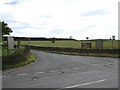
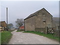
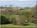
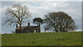
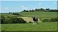
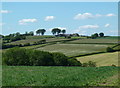
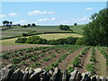
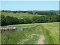
The postcode district of S42 7AS occupies a defined residential cluster within England, covering a total area of 10.2 hectares. This compact space accommodates a population of 2,066 residents, resulting in a density of 79 people per square kilometre. The layout supports a suburban lifestyle where daily living remains closely knit. You will find a neighbourhood that prioritises Quiet living with minimal overcrowding while maintaining easy access to surrounding towns. The area functions as a self-contained community where residents can manage many daily activities locally. Houses dominate the streetscape, reflecting a shared preference among neighbours for detached or semi-detached living arrangements over high-density housing. Daily life centres around manageable distances, allowing most families to walk to local services or catch public transport efficiently. The community feels established, with a clear focus on family stability and long-term residence rather than transient living. When considering living in S42 7AS, you enter a district designed for practicality, where the balance between residential space and community resources creates a functional environment for households seeking independence.
- Area Type
- Postcode
- Area Size
- 10.2 hectares
- Population
- 2066
- Population Density
- 79 people/km²
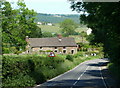
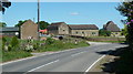
The property market in S42 7AS reflects a distinct lack of rental activity, with home ownership accounting for 78% of all households. This high ownership rate indicates that the market is overwhelmingly dominated by owner-occupiers who have likely purchased their properties over a sustained period. Houses remain the primary accommodation type within the postcode area, meaning you will find a landscape of detached, semi-detached, and perhaps terrace homes rather than flats or apartments. This concentration of freehold properties often appeals to families seeking long-term security and the ability to modify their living space without landlord permission. When examining homes in S42 7AS, buyers should expect a traditional stock suitable for those who value permanence over flexibility. The low rental proportion suggests that the local economy supports sufficient employment to keep residents in their purchased homes rather than moving to private rentals. Prospective buyers looking at this specific cluster must understand that competition will come from other owner-occupiers seeking to upgrade or consolidate, rather than investors or landlords looking for high-yield rental yields.
House Prices in S42 7AS
Showing 2 properties
| Address | Type | Beds | Baths | Last Sale Price | Last Sale Date | |
|---|---|---|---|---|---|---|
| Accommodation At, The Peacock Inn, School Hill, Cutthorpe, S42 7AS | Flat | - | - | - | - | |
| The Peacock Inn, School Hill, Cutthorpe, S42 7AS | Leisure | - | - | - | - |
Energy Efficiency in S42 7AS
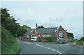
Daily life in S42 7AS benefits from a practical range of amenities within easy reach of homes. Retail options include three significant supermarkets: Co-op Holme, Farmfoods Holme, and Morrisons Daily. These venues cover the majority of grocery shopping and household shopping needs without requiring a journey into a city centre. For public transport, there is one bus station located nearby, alongside the aforementioned rail links to Chesterfield, Dronfield, and Dore & Totley. This infrastructure supports a car-lite lifestyle, though some residents may still own vehicles. While the data does not detail restaurant or leisure venues specifically, the presence of major retail chains suggests a functional high-street environment likely populated with takeaways, cafes, and local services. The area avoids the congestion of a major urban centre but retains the convenience of finding essential goods locally. Living in S42 7AS means your weekly shop is a short drive or walk away, keeping daily chores efficient. The proximity to rail stations also offers commuters the chance to enjoy a scenic journey into town, blending rural tranquility with urban access.
Amenities
Schools
Families living in S42 7AS have access to a selection of educational institutions, predominantly primary schools in the local vicinity. Cutthorpe Primary School operates as a state-funded primary institution and holds a good Ofsted rating. Similarly, Wigley Primary School serves as a state primary school with a good Ofsted rating, offering a solid educational foundation for young learners. You will also find Walton Holymoorside Primary School nearby, which functions as a primary school without a specific Ofsted rating listed in current records. For those seeking alternative education models, Gamelea Countryside Training Trust provides independent schooling options close to the postcode. The mix of state schools and an independent training trust offers flexibility for parents with different educational philosophies. The presence of multiple primary schools supports local families who prefer not to transport children to distant towns. Living in S42 7AS ensures that your children can attend schools within a reasonable distance, reducing travel time and allowing for after-school activities in the local area.
| Rank | School | Type | Entry gender | Ages |
|---|
Explore more schools in this area
Go to Schools tabDemographics
The community in S42 7AS is defined by a mature demographic profile, with adults aged between 30 and 64 years forming the majority of the population. The median age of 47 years confirms that this is an established neighbourhood where most residents have put down roots and secured financial stability. This age structure influences local demand for family-sized homes and stable, long-term tenancies rather than short-term lettings. A significant indicator of this stability is the high level of home ownership, which stands at 78%. Over four out of five households own their properties outright or under a mortgage, creating a market driven by owner-occupiers looking to maintain or extend their existing dwellings. The accommodation type data shows houses as the predominant form of housing, aligning with the lifestyle preferences of the adult workforce and families in the district. Additionally, the predominant ethnic group cited is White, mirroring the broader demographic trends of many rural and semi-rural settlements in this part of the country. This consistency in housing tenure and demographics suggests a residential area with little turnover and a strong sense of local identity.
Household Size
Accommodation Type
Tenure
Ethnic Group
Religion
Household Composition
Age
Household Deprivation
NS-SEC
Explore more demographic insights in this area
Go to Demographics tabPlanning
Planning Constraints
- Flood RiskPremium
- Ramsar Wetland SitesPremium
- Area of Outstanding Natural BeautyPremium
- Protected Nature ReservePremium
- Protected WoodlandPremium