Area Overview for S42 6SP
Photos of S42 6SP
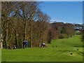
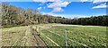
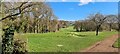
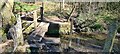
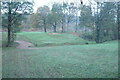
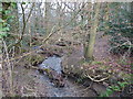
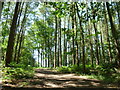
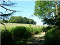
17 photos from this area
Area Information
Key information about the S42 6SP including its size, population, and administrative classification.
- Area Type
- Postcode
- Area Size
- 52.0 hectares
- Population
- 1380
- Population Density
- 1088 people/km²
House Prices in S42 6SP
59
Properties
£270,549
Average Sold Price
£55,000
Lowest Price
£625,000
Highest Price
Showing 59 properties
| Address | Type | Beds | Baths | Last Sale Price | Last Sale Date | |
|---|---|---|---|---|---|---|
| 22 Chartwell Avenue, Wingerworth, S42 6SP | Bungalow | 3 | 1 | £290,000 | Aug 2025 | |
| 12 Chartwell Avenue, Wingerworth, S42 6SP | Bungalow | 3 | 1 | £260,000 | Oct 2024 | |
| 56 Chartwell Avenue, Wingerworth, S42 6SP | Bungalow | 2 | 1 | £280,000 | Jun 2024 | |
| 88 Chartwell Avenue, Wingerworth, S42 6SP | Detached | 5 | 2 | £625,000 | Apr 2024 | |
| 62 Chartwell Avenue, Wingerworth, S42 6SP | Detached | 3 | 2 | £355,000 | Nov 2022 | |
| 20 Chartwell Avenue, Wingerworth, S42 6SP | Detached | 3 | 2 | £270,000 | Sep 2022 | |
| 26 Chartwell Avenue, Wingerworth, S42 6SP | Retail | 3 | 1 | £290,000 | Aug 2022 | |
| 28 Chartwell Avenue, Wingerworth, S42 6SP | Bungalow | - | - | £255,000 | Aug 2021 | |
| 30 Chartwell Avenue, Wingerworth, S42 6SP | Bungalow | - | - | £210,000 | May 2020 | |
| 100 Chartwell Avenue, Wingerworth, S42 6SP | Detached | 6 | 3 | £485,000 | May 2019 |
Page 1 of 6
Energy Efficiency in S42 6SP
Amenities
Schools
| Rank | School | Type | Entry gender | Ages |
|---|
Explore more schools in this area
Go to Schools tabDemographics
Household Size
Two person
most common
Accommodation Type
Houses
most common
Tenure
97
majority
Ethnic Group
White
most common
Religion
N/A
most common
Household Composition
N/A
most common
Age
47
median
Elderly (65+ years)
most common
Household Deprivation
N/A
with no deprivation
NS-SEC
47
in Lower managerial occupations
Explore more demographic insights in this area
Go to Demographics tabPlanning
Planning Constraints
- Flood RiskPremium
- Ramsar Wetland SitesPremium
- Area of Outstanding Natural BeautyPremium
- Protected Nature ReservePremium
- Protected WoodlandPremium