Area Overview for S42 5EN
Photos of S42 5EN
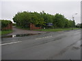

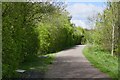
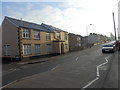
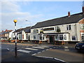
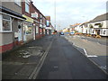
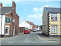
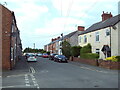
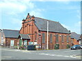
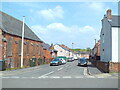
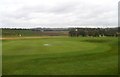
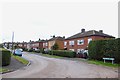
22 photos from this area
Area Information
Key information about the S42 5EN including its size, population, and administrative classification.
- Area Type
- Postcode
- Area Size
- 2.0 hectares
- Population
- 1814
- Population Density
- 4114 people/km²
House Prices in S42 5EN
64
Properties
£103,826
Average Sold Price
£37,000
Lowest Price
£240,000
Highest Price
Showing 64 properties
| Address | Type | Beds | Baths | Last Sale Price | Last Sale Date | |
|---|---|---|---|---|---|---|
| 30 Chapman Lane, Grassmoor, S42 5EN | Terraced | 2 | 1 | £70,000 | Oct 2025 | |
| 15 Chapman Lane, Grassmoor, S42 5EN | Terraced | 2 | 1 | £92,000 | Jul 2025 | |
| 18 Chapman Lane, Grassmoor, S42 5EN | house | 2 | 2 | £117,500 | Jul 2024 | |
| 20 Chapman Lane, Grassmoor, S42 5EN | Terraced | 2 | 1 | £125,000 | Jun 2024 | |
| 73 Chapman Lane, Grassmoor, S42 5EN | Semi-detached | 4 | 2 | £240,000 | Dec 2023 | |
| 17 Chapman Lane, Grassmoor, S42 5EN | Terraced | 2 | 1 | £90,000 | Nov 2023 | |
| 56 Chapman Lane, Grassmoor, S42 5EN | Semi-detached | 2 | - | £74,800 | May 2023 | |
| 26 Chapman Lane, Grassmoor, S42 5EN | Terraced | 2 | 1 | £105,750 | Nov 2022 | |
| 12 Chapman Lane, Grassmoor, S42 5EN | Detached | 3 | 1 | £205,000 | Jul 2022 | |
| 36 Chapman Lane, Grassmoor, S42 5EN | Terraced | 2 | 1 | £99,500 | Dec 2021 |
Page 1 of 7
Energy Efficiency in S42 5EN
Amenities
Schools
| Rank | School | Type | Entry gender | Ages |
|---|
Explore more schools in this area
Go to Schools tabDemographics
Household Size
One person
most common
Accommodation Type
Houses
most common
Tenure
62
majority
Ethnic Group
White
most common
Religion
N/A
most common
Household Composition
N/A
most common
Age
47
median
Adults (30-64 years)
most common
Household Deprivation
N/A
with no deprivation
NS-SEC
27
in Lower managerial occupations
Explore more demographic insights in this area
Go to Demographics tabPlanning
Planning Constraints
- Flood RiskPremium
- Ramsar Wetland SitesPremium
- Area of Outstanding Natural BeautyPremium
- Protected Nature ReservePremium
- Protected WoodlandPremium