Area Overview for S41 9FF
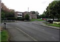
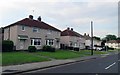
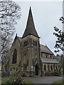
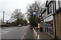
Photos of S41 9FF
Area Information
Living in S41 9FF offers a grounded residential experience within a defined cluster of homes. This specific postcode covers an area of 2202 square metres and supports a population of 1559 people. The density averages 425 people per square kilometre, creating a neighbourhood that feels established yet manageable. You will find a community where daily life revolves around practical accessibility and familiar surroundings. The area functions as a cohesive settlement rather than a sprawling development. Residents typically enjoy quiet streets and a settled atmosphere. The compact size means that local knowledge runs deep. You know your neighbours, and local services are within easy reach. This postcode represents a slice of community life where residents live among each other in a consistent environment. The combination of population size and land area defines a distinct living experience. You are part of a stable population that has grown into this space. The area provides a clear structure for home life without the noise of high-density urban zones. It is a place where you can establish roots without navigating complex urban grids.
- Area Type
- Postcode
- Area Size
- 2202 m²
- Population
- 1559
- Population Density
- 425 people/km²
Homes in S41 9FF belong predominantly to the owners. With 65% home ownership, this is clearly an owner-occupied market rather than a rental hotspot. Houses make up the main accommodation type, appealing to buyers seeking detached or semi-detached living rather than flats. This profile indicates a property market driven by families and empty nesters looking for security. You are unlikely to find high concentrations of short-term lets here. The housing stock focuses on traditional house structures suitable for this population age range. Buyers looking at this small area will find properties designed for long-term residence. The market reflects a desire for solidity over speculation. Houses dominate the landscape, supporting the community structure described in the demographic data. This makes S41 9FF attractive to those seeking a permanent home base. You may find competition higher among buyers due to the strong ownership base. The market operates on the principles of asset stability and community retention.
House Prices in S41 9FF
Showing 5 properties
| Address | Type | Beds | Baths | Last Sale Price | Last Sale Date | |
|---|---|---|---|---|---|---|
| Maple Cottage, 2 Manor Syck Close, Chesterfield, S41 9FF | Detached | 3 | 2 | - | - | |
| Manor Syck Farmhouse, 1 Manor Syck Close, Chesterfield, S41 9FF | Farm | 4 | 3 | - | - | |
| Rose Cottage, 5 Manor Syck Close, Chesterfield, S41 9FF | Semi-detached | 3 | 2 | - | - | |
| Valley View Manor, 4 Manor Syck Close, Chesterfield, S41 9FF | Detached | 5 | 3 | - | - | |
| Brook Cottage, 3 Manor Syck Close, Chesterfield, S41 9FF | house | - | - | - | - |
Energy Efficiency in S41 9FF
Your daily life in S41 9FF includes convenient access to key retail and transport hubs. You can shop at Tesco Chesterfield, Lidl Newbold, and Spar for your everyday groceries and household needs. These three retailers are located within practical reach for residents. Transport links provide further flexibility for your schedule. Three rail stations serve the area: Chesterfield Railway Station, Dronfield Railway Station, and Dore and Totley Railway Station. These options give you control over your commute. Additionally, five metro platforms including Herdings, Birley Lane, and Herdings Park Platform offer local transit. One coach station is also available for longer journeys. This network of bus, rail, and metro services connects you to wider city centres and employment zones. You do not need to drive for every errand or trip. The proximity to these named venues ensures your lifestyle remains balanced between home and activity.
Amenities
Schools
Families in S41 9FF have access to several educational institutions nearby. Mary Swanwick Community Primary School and Mary Swanwick Primary School both operate within the district. You must distinguish between their variations when researching options. Both institutions hold a good Ofsted rating, providing reassurance for parents regarding education quality. Holly House Special School serves specific needs within the local education network. Holly House also appears in the list as another educational entry, potentially serving different demographic groups within the school system. The mix of primary and special needs schools indicates a supportive infrastructure for diverse learning requirements. You will find options for standard primary education alongside specialized support facilities. This variety ensures that children of varying abilities find suitable placement. The presence of two primary school names suggests a robust local offering for early education. Parents living here benefit from this close proximity to state-regulated educational standards.
| Rank | School | Type | Entry gender | Ages |
|---|
Explore more schools in this area
Go to Schools tabDemographics
The community in S41 9FF reflects a mature household structure. The median age stands at 47 years, indicating a population dominated by adults between 30 and 64 years old. Home ownership is a defining feature of the area, with 65% of residents owning their properties outright or with a mortgage. Houses form the primary accommodation type, suggesting families and long-term residents have established themselves here. The predominant ethnic group is White. You will encounter a housing stock that caters to established lifestyles. The high rate of home ownership suggests financial stability among locals. This demographic profile points towards a neighbourhood where people have settled for the long term. The age distribution means you will likely meet residents who value stability and community integration. The absence of a younger teenage skew suggests fewer transient student populations. Instead, the area hosts households likely focused on raising children or caring for older family members. You can expect a crowd that knows the local rhythm and participates in community life actively.
Household Size
Accommodation Type
Tenure
Ethnic Group
Religion
Household Composition
Age
Household Deprivation
NS-SEC
Explore more demographic insights in this area
Go to Demographics tabPlanning
Planning Constraints
- Flood RiskPremium
- Ramsar Wetland SitesPremium
- Area of Outstanding Natural BeautyPremium
- Protected Nature ReservePremium
- Protected WoodlandPremium