Area Overview for S41 7SN
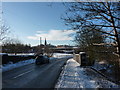
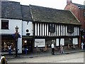
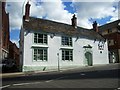
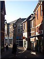
Photos of S41 7SN


Area Information
S41 7SN represents a compact residential cluster within the broader Sheffield postcode framework, serving a population of 1,190 individuals. This specific area functions as a defined neighbourhood where daily life revolves around proximity and established local connections. The community is characterised by its concentrated nature, making it a straightforward choice for those seeking a smaller footprint within the wider region. Residents here experience a quiet domestic setting typical of this specific postcode designation, which covers a limited but distinct geographical zone. The area is not a sprawling suburb but a tight-knit collection of homes where neighbours tend to know one another through inevitable daily interactions. For anyone considering moving to S41 7SN, the scale of the locality promises a manageable environment where access to key local points of interest remains straightforward. The character of the area is defined by this specific residential density, offering a sense of settlement that stands apart from larger urban sprawls or highly developed commercial zones.
- Area Type
- Postcode
- Area Size
- Not available
- Population
- 1190
- Population Density
- 1234 people/km²
The housing stock in S41 7SN is defined almost exclusively by houses, distinguishing it from areas where flats or terraced buildings dominate the landscape. With only 34% home ownership, the market reveals a landscape where renting may be a more common arrangement than buying. This low ownership percentage suggests that a high proportion of the 1,190 residents are tenants, creating a dynamic where landlords hold significant influence over the quality and type of accommodation available. For buyers, this indicates a smaller pool of properties that change hands compared to high-demand investment zones. The prevalence of houses over flats caters to those seeking more space and traditional domestic settings rather than high-density urban living. Prospective purchasers should note that the combination of a small total population and limited ownership rates means the local property market does not experience the fierce bidding wars seen in more desirable commuter belts. The area appeals specifically to those who have settled within the region and chosen this established postcode over other options.
House Prices in S41 7SN
No properties found in this postcode.
Energy Efficiency in S41 7SN
Residents of S41 7SN enjoy convenient access to essential amenities located just beyond the immediate residential boundary. Practical reach includes two major railway stations, Chesterfield Railway Station and Dronfield Railway Station, which facilitate journeys to Leicester, Nottingham, and London. For daily shopping needs, the area is well served by five nearby supermarket options, including Iceland Chesterfield, Tesco Chesterfield, and Spar. These venues are situated within a short distance of the housing cluster, allowing residents to complete errands without requiring extensive travel. There is also a Coach Station available for those preferring long-distance bus travel over rail connections. This network of five retail outlets ensures that grocery requirements and household supplies are met easily by the local population. The area allows homeowners to maintain a quiet domestic life while remaining close to the commercial activities of Chesterfield and Dronfield. Public transport links complement the walkable distance to these key retailers, providing a balanced approach to daily logistics for the local community.
Amenities
Schools
| Rank | School | Type | Entry gender | Ages |
|---|
Explore more schools in this area
Go to Schools tabDemographics
The community profile in S41 7SN is dominated by adults aged between 30 and 64 years, with a median age of 47 indicating a mature working population. This age range suggests households that have likely established their careers and are focused on family stability or retirement preparation rather than the transient lifestyle of younger city dwellers. Only 34% of residents own their homes, which places this specific postcode well below the national average for owner-occupancy rates. The majority of accommodation consists of houses, reflecting a traditional residential preference for standalone or semi-independent living spaces over flats. The population is predominantly White, aligning with the broader demographic patterns of the immediate region. These figures paint a picture of a settles community where the middle-aged demographic forms the core social fabric. The lower rate of home ownership might indicate a significant portion of the 1,190 residents are tenants, possibly living in council properties or private rentals rather than owning freehold or leasehold assets. This dynamic shapes the local culture and economic stability of the neighbourhood.
Household Size
Accommodation Type
Tenure
Ethnic Group
Religion
Household Composition
Age
Household Deprivation
NS-SEC
Explore more demographic insights in this area
Go to Demographics tabPlanning
Planning Constraints
- Flood RiskPremium
- Ramsar Wetland SitesPremium
- Area of Outstanding Natural BeautyPremium
- Protected Nature ReservePremium
- Protected WoodlandPremium