Area Overview for S41 7JA
Photos of S41 7JA
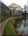
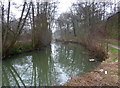
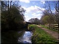
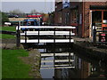


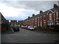
100 photos from this area
Area Information
Key information about the S41 7JA including its size, population, and administrative classification.
- Area Type
- Postcode
- Area Size
- 4936 m²
- Population
- 1496
- Population Density
- 2128 people/km²
House Prices in S41 7JA
30
Properties
£66,620
Average Sold Price
£16,000
Lowest Price
£155,000
Highest Price
Showing 30 properties
| Address | Type | Beds | Baths | Last Sale Price | Last Sale Date | |
|---|---|---|---|---|---|---|
| 25 Lockoford Lane, Chesterfield, S41 7JA | Terraced | 2 | 1 | £155,000 | Jun 2025 | |
| 39 Lockoford Lane, Chesterfield, S41 7JA | house | - | - | £130,000 | Mar 2021 | |
| 23 Lockoford Lane, Chesterfield, S41 7JA | Terraced | 2 | 2 | £118,000 | Dec 2020 | |
| 41 Lockoford Lane, Chesterfield, S41 7JA | Semi-detached | 3 | 1 | £111,000 | Jan 2018 | |
| 17 Lockoford Lane, Chesterfield, S41 7JA | Terraced | 2 | - | £64,500 | Aug 2014 | |
| 13 Lockoford Lane, Chesterfield, S41 7JA | Terraced | 2 | 1 | £72,000 | Mar 2010 | |
| 33 Lockoford Lane, Chesterfield, S41 7JA | Terraced | 3 | 1 | £95,000 | Mar 2010 | |
| 21 Lockoford Lane, Chesterfield, S41 7JA | Terraced | - | - | £86,000 | Aug 2009 | |
| 43 Lockoford Lane, Chesterfield, S41 7JA | Semi-detached | - | - | £96,250 | Feb 2005 | |
| 29 Lockoford Lane, Chesterfield, S41 7JA | house | - | - | £68,500 | Oct 2003 |
Page 1 of 3
Energy Efficiency in S41 7JA
Amenities
Schools
| Rank | School | Type | Entry gender | Ages |
|---|
Explore more schools in this area
Go to Schools tabDemographics
Household Size
One person
most common
Accommodation Type
Houses
most common
Tenure
49
majority
Ethnic Group
White
most common
Religion
N/A
most common
Household Composition
N/A
most common
Age
47
median
Adults (30-64 years)
most common
Household Deprivation
N/A
with no deprivation
NS-SEC
24
in Lower managerial occupations
Explore more demographic insights in this area
Go to Demographics tabPlanning
Planning Constraints
- Flood RiskPremium
- Ramsar Wetland SitesPremium
- Area of Outstanding Natural BeautyPremium
- Protected Nature ReservePremium
- Protected WoodlandPremium