Area Overview for S41 7HF
Photos of S41 7HF
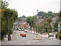
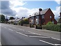
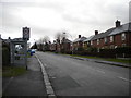
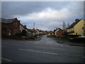

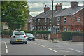
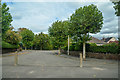
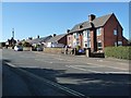
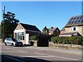
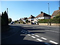
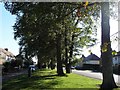
34 photos from this area
Area Information
Key information about the S41 7HF including its size, population, and administrative classification.
- Area Type
- Postcode
- Area Size
- 1.7 hectares
- Population
- 1335
- Population Density
- 4129 people/km²
House Prices in S41 7HF
40
Properties
£115,996
Average Sold Price
£35,000
Lowest Price
£215,000
Highest Price
Showing 40 properties
| Address | Type | Beds | Baths | Last Sale Price | Last Sale Date | |
|---|---|---|---|---|---|---|
| 29 Edinburgh Road, Newbold, S41 7HF | Semi-detached | 3 | 1 | £215,000 | Apr 2025 | |
| 33 Edinburgh Road, Newbold, S41 7HF | Semi-detached | 3 | 2 | £195,000 | Mar 2025 | |
| 61 Edinburgh Road, Newbold, S41 7HF | Semi-detached | 3 | 1 | £150,000 | Jun 2023 | |
| 51 Edinburgh Road, Newbold, S41 7HF | house | - | - | £188,000 | Dec 2022 | |
| 13 Edinburgh Road, Newbold, S41 7HF | house | - | - | £85,000 | Dec 2019 | |
| 37 Edinburgh Road, Newbold, S41 7HF | house | - | - | £90,000 | Sep 2014 | |
| 59 Edinburgh Road, Newbold, S41 7HF | Flat | - | - | £39,950 | Jun 2013 | |
| 55 Edinburgh Road, Newbold, S41 7HF | Flat | 2 | 1 | £35,000 | Mar 2013 | |
| 47 Edinburgh Road, Newbold, S41 7HF | house | - | - | £120,000 | Feb 2010 | |
| 25 Edinburgh Road, Newbold, S41 7HF | Semi-detached | - | - | £125,000 | Jul 2005 |
Page 1 of 4
Energy Efficiency in S41 7HF
Amenities
Schools
| Rank | School | Type | Entry gender | Ages |
|---|
Explore more schools in this area
Go to Schools tabDemographics
Household Size
One person
most common
Accommodation Type
Houses
most common
Tenure
48
majority
Ethnic Group
White
most common
Religion
N/A
most common
Household Composition
N/A
most common
Age
47
median
Adults (30-64 years)
most common
Household Deprivation
N/A
with no deprivation
NS-SEC
25
in Lower managerial occupations
Explore more demographic insights in this area
Go to Demographics tabPlanning
Planning Constraints
- Flood RiskPremium
- Ramsar Wetland SitesPremium
- Area of Outstanding Natural BeautyPremium
- Protected Nature ReservePremium
- Protected WoodlandPremium