Area Overview for S41 0XL
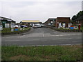
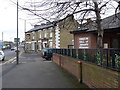
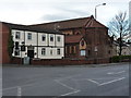
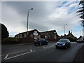
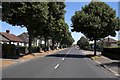
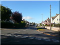
Photos of S41 0XL


Area Information
Postal code S41 0XL represents a tightly knit residential cluster situated in the wider Chesterfield region of Derbyshire. This specific postcode covers just 6525 square metres, yet it houses 2210 residents. Consequently, the area reaches a population density of 2192 people per square kilometre. That is a very high density for what is described as a small residential cluster. The location functions within England, offering a compact community experience rather than open rural independence. Living in S41 0XL means you are part of a dense neighbourhood where space is at a premium. The sheer concentration of people on such a limited land footprint creates a distinctive living environment. Unlike sprawling suburbs with large gardens, this cluster demands a different lifestyle suited to close proximity with neighbours. Expect a lived-in feel where daily interactions are likely to be frequent due to the packed arrangement. This specific postcode acts as a concentrated hub within the broader S41 framework. It is a place defined by its compactness and high population concentration. You are looking at a community where every square metre counts towards the total population count.
- Area Type
- Postcode
- Area Size
- 6525 m²
- Population
- 2210
- Population Density
- 2192 people/km²
Housing in S41 0XL is characterised by a strong preference for freehold properties. Your chance of buying a house that changes hands frequently is lower because 79% of residents are homeowners. This high ownership rate contrasts sharply with areas where investment buyers or young professionals dominate. The accommodation type is almost exclusively houses, which removes the constraint of finding flats or bungalows if you have a preference. Living in this postcode means you are almost certainly looking at a detached or semi-detached property. There are no flats listed for this specific cluster, which narrows your options if you require shared ownership schemes. The market here functions on long-term retention rather than rapid turnover. A prospective buyer must accept that properties are likely held by long-term families rather than transient renters. This environment suits borrowers who intend to stay in one home for a decade or more. The 79% ownership figure indicates a entrenched owner-occupier market unlike any rental-heavy zone. You will not find the typical pressure of bidding wars common in high-demand rental conversions. Instead, the market reflects a stable, owner-led community where houses remain with families for generations.
House Prices in S41 0XL
Showing 13 properties
| Address | Type | Beds | Baths | Last Sale Price | Last Sale Date | |
|---|---|---|---|---|---|---|
| 8 Knighton Close, Hasland, S41 0XL | Semi-detached | 3 | 2 | £245,000 | Jan 2024 | |
| 3 Knighton Close, Hasland, S41 0XL | house | - | - | £217,000 | Jan 2021 | |
| 6 Knighton Close, Hasland, S41 0XL | Detached | 4 | 2 | £285,000 | Jan 2021 | |
| 2 Knighton Close, Hasland, S41 0XL | house | - | - | £335,000 | Jan 2020 | |
| 16 Knighton Close, Hasland, S41 0XL | Semi-detached | 2 | 2 | £154,000 | Mar 2016 | |
| 4 Knighton Close, Hasland, S41 0XL | house | 3 | - | £170,000 | Dec 2009 | |
| 18 Knighton Close, Hasland, S41 0XL | Terraced | 3 | 2 | £190,000 | Jan 2008 | |
| 12 Knighton Close, Hasland, S41 0XL | Terraced | - | - | £156,950 | Apr 2007 | |
| 5 Knighton Close, Hasland, S41 0XL | Terraced | 3 | - | £179,950 | Apr 2007 | |
| 14 Knighton Close, Hasland, S41 0XL | Terraced | - | - | £164,000 | Aug 2006 |
Energy Efficiency in S41 0XL
Daily life in S41 0XL is defined by proximity to three major supermarket chains. You can visit Asda Birdholme, Co-op Hasland, and Tesco Chesterfield for your weekly shopping and household needs. These three retailers provide a comprehensive selection of groceries, convenience items, and household essentials. Retail dominance is the primary amenity category, with five notable venues driving local convenience. You will not find a wealth of leisure parks listed, but the accessibility of major food retailers ensures your day-to-day convenience. Public transport is anchored by the Coach Station for bus services, whilst Chesterfield Railway Station and Dronfield Railway Station handle rail travel. This mix allows you to reach broader regional cities without a car. Living in S41 0XL means your shopping trips are covered by three of the largest UK supermarket chains in one network. The retail landscape is practical rather than focused on boutique dining or nightlife. You have everything you need for your household stored in these three major outlets. The coach station and railway stations ensure you can leave the area quickly if you need to travel for work or leisure. Your lifestyle revolves around reliable access to food supplies and efficient transport links rather than local leisure hubs.
Amenities
Schools
Families in S41 0XL have access to three specific educational institutions within their immediate vicinity. First is the North East Derbyshire Support Centre, a facility classified as other. Nearby, the Step Forward Educational Trust operates an independent school in Chesterfield. Finally, Esteem North Academy is also categorized as an other type institution. The mix of independent and other provision suggests a community focused on alternative or special needs education rather than standard state schooling. You do not have access to a typical secondary school or mainstream primary from this specific list. The presence of Step Forward Educational Trust indicates some access to private education options just outside the postcode boundary. However, the majority of the listed institutions fall under the other category, which often supports children with complex learning needs. If you are buying for a child with standard educational needs, you will need to look further afield for a comprehensive academy or large independent school. The school list does not include traditional comprehensive colleges or large primary clusters. This suggests the local provision is specialised rather than general. You must plan your commute carefully if you require a standard state school curriculum for your children. The three schools named are the only options listed for the S41 0XL area.
| Rank | School | Type | Entry gender | Ages |
|---|
Explore more schools in this area
Go to Schools tabDemographics
The community within S41 0XL is dominated by adults aged between 30 and 64 years. Your average resident is 47 years old, indicating a mature household profile. Home ownership stands at 79%, meaning most people in this cluster own their properties outright or with a mortgage. There is minimal renting activity compared to major rental markets. Houses form the primary accommodation type, which aligns with the high ownership rate andresident age profile. The predominant ethnic group is White, reflecting the typical demographic make-up of many areas in this part of Derbyshire. It is an established community where the majority of families have roots in the local area. The age range suggests that young families and older adults find this environment stable and reliable. With 79% of residents owning their homes, the community likely values stability over transient living arrangements. The 47-year median age points to a neighbourhood where established careers and lifecycle events dominate social life. You will encounter residents who have called this area home for many years. The demographic data shows a consistent pattern of adult residency and property ownership. This stability offers a predictable environment for anyone considering moving into S41 0XL.
Household Size
Accommodation Type
Tenure
Ethnic Group
Religion
Household Composition
Age
Household Deprivation
NS-SEC
Explore more demographic insights in this area
Go to Demographics tabPlanning
Planning Constraints
- Flood RiskPremium
- Ramsar Wetland SitesPremium
- Area of Outstanding Natural BeautyPremium
- Protected Nature ReservePremium
- Protected WoodlandPremium