Area Overview for S41 0UQ
Photos of S41 0UQ
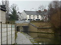

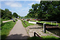

![Station Road, Brimington [B6050] in S41 0UQ](https://images.propbar.co.uk/images/geograph/59/56/5956915_120.jpg)
47 photos from this area
Area Information
Key information about the S41 0UQ including its size, population, and administrative classification.
- Area Type
- Postcode
- Area Size
- 5.1 hectares
- Population
- 1874
- Population Density
- 2938 people/km²
House Prices in S41 0UQ
25
Properties
£352,725
Average Sold Price
£280,995
Lowest Price
£522,000
Highest Price
Showing 25 properties
| Address | Type | Beds | Baths | Last Sale Price | Last Sale Date | |
|---|---|---|---|---|---|---|
| 8 Canalside Crescent, Chesterfield, S41 0UQ | Detached | 4 | 3 | £440,000 | Apr 2025 | |
| 29 Canalside Crescent, Chesterfield, S41 0UQ | Detached | 5 | 3 | £522,000 | Nov 2023 | |
| 9 Canalside Crescent, Chesterfield, S41 0UQ | Detached | 4 | 2 | £420,000 | Jul 2023 | |
| 1 Canalside Crescent, Chesterfield, S41 0UQ | house | - | - | £478,495 | Nov 2022 | |
| 31 Canalside Crescent, Chesterfield, S41 0UQ | house | - | - | £499,995 | Dec 2020 | |
| 33 Canalside Crescent, Chesterfield, S41 0UQ | house | - | - | £295,995 | Aug 2020 | |
| 27 Canalside Crescent, Chesterfield, S41 0UQ | house | - | - | £334,995 | Jul 2020 | |
| 18 Canalside Crescent, Chesterfield, S41 0UQ | house | - | - | £334,995 | Jun 2020 | |
| 16 Canalside Crescent, Chesterfield, S41 0UQ | house | - | - | £369,995 | Jun 2020 | |
| 12 Canalside Crescent, Chesterfield, S41 0UQ | house | - | - | £295,995 | Mar 2020 |
Page 1 of 3
Energy Efficiency in S41 0UQ
Amenities
Schools
| Rank | School | Type | Entry gender | Ages |
|---|
Explore more schools in this area
Go to Schools tabDemographics
Household Size
One person
most common
Accommodation Type
Houses
most common
Tenure
53
majority
Ethnic Group
White
most common
Religion
N/A
most common
Household Composition
N/A
most common
Age
47
median
Adults (30-64 years)
most common
Household Deprivation
N/A
with no deprivation
NS-SEC
27
in Lower managerial occupations
Explore more demographic insights in this area
Go to Demographics tabPlanning
Planning Constraints
- Flood RiskPremium
- Ramsar Wetland SitesPremium
- Area of Outstanding Natural BeautyPremium
- Protected Nature ReservePremium
- Protected WoodlandPremium