Area Overview for S41 0HG
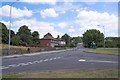
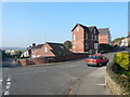
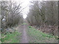
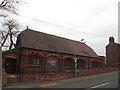
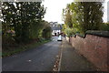
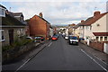
Photos of S41 0HG


Area Information
S41 0HG is a compact residential cluster in England that serves over 1,477 residents. This specific postcode covers just 5,533 square metres, making it one of the smallest and most densely populated spots on the map. Despite its minuscule size, the area supports a substantial local population with a record-breaking density of 266,928 people per square kilometre. Living in S41 0HG means you are part of a tightly knit community where neighbours are never far away. The neighbourhood is entirely focused on residential use, creating a quiet environment distinct from the surrounding urban sprawl. You can expect a safe neighbourhood where daily life is defined by close proximity rather than vast distances. This high density ensures that essential services are nearby, yet the lack of extensive commercial space within the immediate 5,533 square metre boundary keeps the footprint residential. The area functions as a distinct bubble within the wider Chesterfield region, offering a specific slice of suburban life for families and individuals seeking a defined community space.
- Area Type
- Postcode
- Area Size
- 5533 m²
- Population
- 1477
- Population Density
- 2788 people/km²
The housing market in S41 0HG is characterised by a strong emphasis on owner-occupation. With 75% of residents owning their homes, this area operates primarily as a buyer's market rather than a rental hub. This statistic reveals a stable stock of properties where residents have likely invested in their surroundings for many years. Houses are the standard accommodation type here, meaning you will not find the high-rise blocks or purpose-built rentals common in city centres. The small geographical footprint of 5,533 square metres limits the total number of properties available, ensuring that the local property scene remains consistent. For anyone considering homes in S41 0HG, the very high ownership rate suggests that new buyers will find an established, non-transient community. The area is not a flightpath for short-term lets, making it ideal for those seeking permanence. The housing stock is likely comprised of detached or semi-detached family homes that suit the demographic profile of the 47-year-old median resident. This creates a predictable market where property values are driven by local demand rather than transient investment trends.
House Prices in S41 0HG
Showing 12 properties
| Address | Type | Beds | Baths | Last Sale Price | Last Sale Date | |
|---|---|---|---|---|---|---|
| 5 Spital Gardens, Spital, Chesterfield, S41 0HG | house | 2 | - | £130,000 | Mar 2023 | |
| 3 Spital Gardens, Spital, Chesterfield, S41 0HG | Terraced | 2 | 1 | £112,000 | Aug 2015 | |
| 9 Spital Gardens, Spital, Chesterfield, S41 0HG | Terraced | 2 | 1 | £95,000 | May 2007 | |
| Pear Tree Cottage, 2 Spital Gardens, Spital, Chesterfield, S41 0HG | Terraced | 2 | 1 | £26,500 | Feb 2000 | |
| 8 Spital Gardens, Spital, Chesterfield, S41 0HG | Terraced | 2 | 1 | - | - | |
| 11 Spital Gardens, Spital, Chesterfield, S41 0HG | Terraced | - | - | - | - | |
| 1 Spital Gardens, Spital, Chesterfield, S41 0HG | Terraced | - | - | - | - | |
| 6 Spital Gardens, Spital, Chesterfield, S41 0HG | Terraced | - | - | - | - | |
| 7 Spital Gardens, Spital, Chesterfield, S41 0HG | Detached | - | - | - | - | |
| 7A Spital Gardens, Spital, Chesterfield, S41 0HG | house | - | - | - | - |
Energy Efficiency in S41 0HG
Daily life in S41 0HG benefits from excellent access to key amenities just outside the small residential boundary. You have choice within the retail category; nearby venues include Co-op Chesterfield, Asda Living, and Iceland Chesterfield. This selection means you can do your weekly grocery shopping for essentials and household goods without travelling far. Two railway stations provide rail links, identified as Chesterfield Railway Station and Dronfield Railway Station. These stops offer direct connections to the wider region, giving you flexibility for commuting or leisure travel. There is also one notable bus stop, the Coach Station, which acts as a hub for longer distance bus services. Living in S41 0HG means you are central enough to catch a train or bus quickly while retaining a residential focus. The proximity to these five retail outlets and three transport hubs ensures your daily errands require minimal effort. This layout provides a convenient lifestyle where essential services are always within practical reach, balancing the quiet of a residential cluster with the accessibility of a town centre nearby.
Amenities
Schools
| Rank | School | Type | Entry gender | Ages |
|---|
Explore more schools in this area
Go to Schools tabDemographics
The community in S41 0HG is mature, reflecting a stable and established local population. The median age sits at 47 years, confirming that adults between 30 and 64 years old form the most common age range. This demographic profile suggests a area dominated by families and empty nesters rather than young adults or retirees. Home ownership is a cornerstone of life here, with 75% of residents owning their homes outright or with a mortgage. This high rate indicates financial stability and a long-term commitment to the locality. Houses remain the predominant form of accommodation, shaping the street scene and garden culture throughout the postcode. The predominant ethnic group is White, reflecting the traditional character of the settlement. With such a high ownership rate and age profile, the community likely values quiet streets and family-friendly environments. Living in S41 0HG offers a sense of security and stability that appeals to householders looking to put down roots. The lack of significant student or transient populations further reinforces the settled nature of the neighbourhood.
Household Size
Accommodation Type
Tenure
Ethnic Group
Religion
Household Composition
Age
Household Deprivation
NS-SEC
Explore more demographic insights in this area
Go to Demographics tabPlanning
Planning Constraints
- Flood RiskPremium
- Ramsar Wetland SitesPremium
- Area of Outstanding Natural BeautyPremium
- Protected Nature ReservePremium
- Protected WoodlandPremium