Area Overview for S40 2TP
Photos of S40 2TP
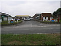
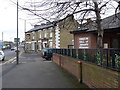
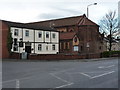
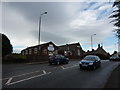

50 photos from this area
Area Information
Key information about the S40 2TP including its size, population, and administrative classification.
- Area Type
- Postcode
- Area Size
- 9996 m²
- Population
- 2210
- Population Density
- 2192 people/km²
House Prices in S40 2TP
25
Properties
£95,643
Average Sold Price
£30,000
Lowest Price
£147,000
Highest Price
Showing 25 properties
| Address | Type | Beds | Baths | Last Sale Price | Last Sale Date | |
|---|---|---|---|---|---|---|
| 65 Rothervale Road, Chesterfield, S40 2TP | Semi-detached | 2 | 1 | £145,000 | Feb 2025 | |
| 63 Rothervale Road, Chesterfield, S40 2TP | Semi-detached | 2 | 1 | £140,000 | Jul 2024 | |
| 69 Rothervale Road, Chesterfield, S40 2TP | Semi-detached | 2 | 1 | £147,000 | Mar 2024 | |
| 77 Rothervale Road, Chesterfield, S40 2TP | house | - | - | £140,000 | Dec 2023 | |
| 73 Rothervale Road, Chesterfield, S40 2TP | Semi-detached | 2 | 1 | £115,000 | Oct 2021 | |
| 66 Rothervale Road, Chesterfield, S40 2TP | Semi-detached | 2 | - | £86,500 | Aug 2020 | |
| 64 Rothervale Road, Chesterfield, S40 2TP | Semi-detached | 2 | 1 | £130,000 | Dec 2019 | |
| 72 Rothervale Road, Chesterfield, S40 2TP | Terraced | 2 | 1 | £88,000 | Jan 2019 | |
| 74 Rothervale Road, Chesterfield, S40 2TP | Terraced | 2 | 1 | £50,000 | Apr 2014 | |
| 82 Rothervale Road, Chesterfield, S40 2TP | house | 2 | - | £88,500 | Oct 2010 |
Page 1 of 3
Energy Efficiency in S40 2TP
Amenities
Schools
| Rank | School | Type | Entry gender | Ages |
|---|
Explore more schools in this area
Go to Schools tabDemographics
Household Size
Two person
most common
Accommodation Type
Houses
most common
Tenure
79
majority
Ethnic Group
White
most common
Religion
N/A
most common
Household Composition
N/A
most common
Age
47
median
Adults (30-64 years)
most common
Household Deprivation
N/A
with no deprivation
NS-SEC
34
in Lower managerial occupations
Explore more demographic insights in this area
Go to Demographics tabPlanning
Planning Constraints
- Flood RiskPremium
- Ramsar Wetland SitesPremium
- Area of Outstanding Natural BeautyPremium
- Protected Nature ReservePremium
- Protected WoodlandPremium