Area Overview for S40 2RA
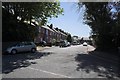
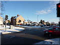
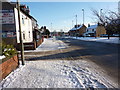
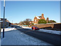
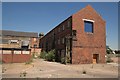
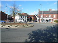
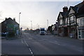
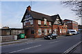
Photos of S40 2RA

Area Information
Living in S40 2RA presents a distinct lifestyle within a small residential cluster in Derbyshire, England. This specific postcode covers a modest community where one thousand four hundred and fifty-three people call the area home. The setting is defined by close proximity to key transport hubs and essential services rather than sprawling urban development. Residents here enjoy a solid score of ninety-seven for fixed broadband quality, ensuring reliable internet connections for modern work and leisure needs. Mobile network performance remains strong with an eighty-five score, supporting daily connectivity. The area passes safety checks regarding flood risk, Ramsar wetlands, Areas of Outstanding Natural Beauty, protected nature reserves, and protected woodland, indicating no significant environmental planning constraints. Daily life revolves around practical accessibility. You have quick access to five major retail locations, including Morrisons Brampton, Lidl Chesterfield, and Co-op Chesterfield. Transport links are robust, with access to one coach station, two railway stations at Chesterfield and Dronfield, facilitating easy travel beyond the immediate vicinity. The environment remains quiet and low-risk from natural hazards, focusing the community's attention on local amenities and residential living rather than navigating complex planning restrictions.
- Area Type
- Postcode
- Area Size
- Not available
- Population
- 1453
- Population Density
- 5118 people/km²
The property market in S40 2RA is characterised by a fifty per cent rate of home ownership. This statistic indicates that the area is split evenly between those who have bought their homes and those who rent. Consequently, you will encounter a balanced market where existing owners are likely to sell alongside potential landlord properties. The accommodation type data identifies houses as the predominant form of housing. This means you will primarily find detached or semi-detached properties rather than high-rise apartments or purpose-built rental flats. As a small residential cluster, the housing stock focuses on traditional house designs suited to the Derbyshire landscape. Buyers looking at homes in S40 2RA should expect a variety of family-sized properties owned by previous residents who are moving to larger homes or downsizing. The fifty per cent ownership rate suggests a healthy turnover where some sellers have held their property for extended periods while others may be entering the market as investors or landlords. The lack of recorded flats data further narrows the search specifically to house buyers, eliminating the need to consider leasehold apartment complexes in your search strategy for this area.
House Prices in S40 2RA
No properties found in this postcode.
Energy Efficiency in S40 2RA
Residents of S40 2RA benefit from a specific cluster of high-street retail options within practical reach. You can shop at Morrisons Brampton, Lidl Chesterfield, and Co-op Chesterfield, which collectively create a convenient shopping environment for groceries, household goods, and essential items. The presence of five major retail outlets ensures you do not need to travel far for daily necessities. Beyond food shopping, transport amenities are plentiful with two railway stations and one coach station nearby. Life here is defined by convenience rather than nightlife or entertainment districts. The retail focus suggests a lifestyle built around practical errands and family-oriented shopping trips. While the area is small, the density of major supermarkets like Lidl and Morrisons means you have access to competitive pricing and wide product ranges without leaving the immediate area. The transport links to Chesterfield and Dronfield also open up wider leisure and dining options if you prefer a day out over daily shopping.
Amenities
Schools
Residents of S40 2RA have access to Old Hall Junior School, which functions as a primary academy. This institution serves as the key educational facility for children in the immediate vicinity. As an academy, it operates under direct state funding while maintaining its own governance structure. The presence of an academy alongside a primary designation indicates a focused educational path for younger students without a separate secondary option listed within the immediate data set for this specific postcode. For families considering schools near S40 2RA, Old Hall Junior School stands as the only named educational establishment provided. You should verify the specific Ofsted rating and year-group range directly, as the data identifies the school type but does not list a specific inspection line. The concentration of primary education options suggests that parents seeking comprehensive education from nursery through to secondary years may need to look further afield for their secondary school choices. However, the proximity to Old Hall Junior School provides a strong foundation for early years schooling within the local community.
| Rank | School | Type | Entry gender | Ages |
|---|
Explore more schools in this area
Go to Schools tabDemographics
The community in S40 2RA reflects an established neighbourhood with a median age of forty-seven years. Adults aged between thirty and sixty-four form the most common age range, suggesting a population dominated by mature households rather than young families or the elderly living alone. This age profile typically correlates with a stable, long-term resident base seeking quiet surroundings. Home ownership stands at exactly fifty per cent, creating a balanced mix between owner-occupiers and renters. You will find mostly houses rather than flats, aligning with the preferences of families and empty-nesters in this rural Derbyshire setting. Ethnically, white residents comprise the predominant group within this specific postcode area. While the area is multicultural in the wider sense, the data indicates a clear majority for the white demographic. The accommodation type data confirms that the housing stock consists primarily of houses. This demographic structure creates a community familiar with long-term property investment and maintenance. The absence of significant young professional clusters or student populations reinforces the character as a settled family or retirement-oriented location.
Household Size
Accommodation Type
Tenure
Ethnic Group
Religion
Household Composition
Age
Household Deprivation
NS-SEC
Explore more demographic insights in this area
Go to Demographics tabPlanning
Planning Constraints
- Flood RiskPremium
- Ramsar Wetland SitesPremium
- Area of Outstanding Natural BeautyPremium
- Protected Nature ReservePremium
- Protected WoodlandPremium