Area Overview for S40 2LP
Photos of S40 2LP
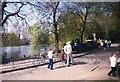
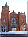
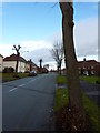
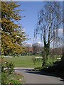
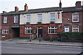
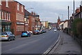

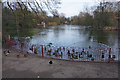
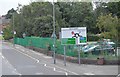
72 photos from this area
Area Information
Key information about the S40 2LP including its size, population, and administrative classification.
- Area Type
- Postcode
- Area Size
- 2.0 hectares
- Population
- 1734
- Population Density
- 3556 people/km²
House Prices in S40 2LP
51
Properties
£118,518
Average Sold Price
£43,750
Lowest Price
£215,000
Highest Price
Showing 51 properties
| Address | Type | Beds | Baths | Last Sale Price | Last Sale Date | |
|---|---|---|---|---|---|---|
| 75 Park Road, Chesterfield, S40 2LP | Semi-detached | 4 | 1 | £215,000 | May 2024 | |
| 39 Park Road, Chesterfield, S40 2LP | Semi-detached | 4 | 1 | £182,500 | Mar 2024 | |
| 65 Park Road, Chesterfield, S40 2LP | house | - | - | £157,000 | May 2021 | |
| 47 Park Road, Chesterfield, S40 2LP | house | - | - | £122,000 | Mar 2021 | |
| 208 Park Road, Chesterfield, S40 2LP | Semi-detached | 4 | - | £115,000 | Jul 2017 | |
| 198 Park Road, Chesterfield, S40 2LP | Semi-detached | 4 | - | £120,000 | Jun 2017 | |
| 220 Park Road, Chesterfield, S40 2LP | Semi-detached | 4 | 2 | £135,000 | Nov 2016 | |
| 45 Park Road, Chesterfield, S40 2LP | Semi-detached | 3 | 1 | £107,000 | Jun 2016 | |
| 77 Park Road, Chesterfield, S40 2LP | Semi-detached | - | - | £75,000 | Oct 2010 | |
| 79 Park Road, Chesterfield, S40 2LP | house | 4 | - | £115,000 | May 2010 |
Page 1 of 6
Energy Efficiency in S40 2LP
Amenities
Schools
| Rank | School | Type | Entry gender | Ages |
|---|
Explore more schools in this area
Go to Schools tabDemographics
Household Size
Two person
most common
Accommodation Type
Houses
most common
Tenure
53
majority
Ethnic Group
White
most common
Religion
N/A
most common
Household Composition
N/A
most common
Age
47
median
Adults (30-64 years)
most common
Household Deprivation
N/A
with no deprivation
NS-SEC
27
in Lower managerial occupations
Explore more demographic insights in this area
Go to Demographics tabPlanning
Planning Constraints
- Flood RiskPremium
- Ramsar Wetland SitesPremium
- Area of Outstanding Natural BeautyPremium
- Protected Nature ReservePremium
- Protected WoodlandPremium