Area Overview for S33 9WY
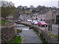
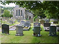
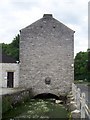
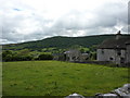
Photos of S33 9WY
Area Information
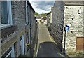
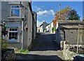
S33 9WY represents a specific residential cluster within the broader Derbyshire landscape, defined by its small population of 1,787 people. The area accommodates approximately 74 people per square kilometre, creating a considerably low-density environment suitable for those seeking quiet country living. This postcode serves as a modest hub for a primarily residential community rather than a commercial centre. Daily life here revolves around proximity to local villages and transport links rather than urban convenience. Residents enjoy a distinct separation from the hustle of larger towns, which shapes a slower-paced existence. The setting appeals to individuals who value space and tranquility over proximity to major city centres. Living in S33 9WY means accepting a rural lifestyle where distances to amenities are greater than in more populated districts. The area functions as a quiet retreat for locals who intend to spend most of their time working remotely or commuting to nearby employment hubs. Housing stock here forms the backbone of community stability, withestate development focused on maintaining existing single-family homes. This small footprint ensures that the local character remains consistent, with few changes to the built environment expected in the foreseeable future.
- Area Type
- Postcode
- Area Size
- Not available
- Population
- 1787
- Population Density
- 74 people/km²
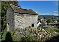
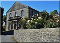
Homes in S33 9WY are characterised by a low level of rental activity and a strong preference for owner-occupancy. The record showing 76% home ownership indicates that the vast majority of households have purchased their properties, suggesting limited pressure from first-time buyers seeking rented accommodation. This high ownership rate creates a stable market where property values tend to reflect long-term investment rather than speculative short-term gains. Houses make up the entire specified accommodation type for this area, meaning prospective buyers can expect to find detached or semi-detached dwellings rather than flats or shared houses. The small population of 1,787 housing stock that prioritises space and privacy for families or retirees. Given the density of just 74 people per square kilometre, new developments are unlikely, limiting supply and potentially supporting higher price points for existing listings. The market here does not cater to the high-density urban rental sector but instead serves individuals looking to purchase a permanent residence. Buyers considering this postcode should note that inventory will consist almost exclusively of houses suited for private ownership. The lack of social housing or large blocks of flats reinforces the exclusive, neighbourhood-focused nature of the property stock available for sale.
House Prices in S33 9WY
No properties found in this postcode.
Energy Efficiency in S33 9WY
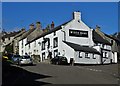
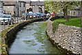
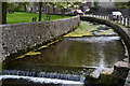
Residents of S33 9WY enjoy a lifestyle defined by proximity to essential local services and transport hubs nearby. The area lies within practical reach of six retail locations, including Co-op Bradwell, Spar, and Co-op Tideswell. These supermarkets and convenience stores provide daily necessities without the need to travel far into larger towns. For those commuting, five railway stations offer connections to wider networks, with Hope Railway Station, Bamford Railway Station, and Hathersage Railway Station listed as key departure points. These rail links facilitate travel to cities like Manchester and Derby, making the rural setting viable for full-time employment outside the village. The combination of nearby retail outlets and accessible train services creates a balanced routine where leisure shopping and professional obligations can be managed without excessive driving. Local amenities are concentrated in the immediate vicinity, reducing reliance on major arterial roads for daily tasks. This arrangement supports a low-stress morning and evening commute while keeping errands quick and straightforward. Living in S33 9WY means having core requirements met locally while retaining the option to venture further for specialised services or entertainment.
Amenities
Schools
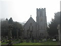
Families considering homes in S33 9WY have access to a defined network of educational institutions within practical reach. Local options include Bradwell Junior School, which operates as an academy providing secondary education for younger students. For early years education, parents can choose between Bradwell CofE (Controlled) Infant School and Great Hucklow CE Primary School, both of which hold a good Ofsted rating. These schools offer a Christian educational foundation alongside standard curriculum requirements. Although Bradwell Junior School appears twice in available records, its status as an academy suggests a commitment to modern pedagogical standards. The presence of two primary institutions, one controlled and one Church of England voluntary aided, provides families with a choice in religious education without compromising on academic quality. The good rating from Ofsted for the infant and primary schools indicates satisfaction with educational outcomes, leadership, and student development. While higher education institutions are not listed, the availability of these quality primary and junior schools ensures that local children can receive a solid foundation in their neighbourhood before transferring to secondary options elsewhere. The mix of academy and controlled school types offers diversity in governance while maintaining a consistent standard of care and learning.
| Rank | School | Type | Entry gender | Ages |
|---|
Explore more schools in this area
Go to Schools tabDemographics
The community residing in S33 9WY displays a mature demographic profile centred on adults between the ages of 30 and 64 years. The median age for residents stands at exactly 47 years, indicating a population dominated by middle-aged adults rather than young families or school-age children. This age distribution suggests a neighbourhood where long-term residents have established roots rather than a transient population of students or young professionals. Home ownership is remarkably high within this postcode, with 76% of households owning their homes outright. This figure reflects a stable community where mortgage commitments have largely been cleared, leading to a lower rate of repossession risk compared to national averages. Houses constitute the predominant accommodation type, aligning with the preference for detached or semi-detached family living found in the Derbyshire countryside. The area is predominantly home to individuals identifying as White, mirroring the broader demographic trends of the surrounding rural regions of Great Hucklow and Bramhall. This homogeneity contributes to a settled local culture where neighbours have known each other for generations. The demographic data paints a clear picture of a conservative, established community where change occurs gradually and official statistics reflect deep-rooted residency patterns.
Household Size
Accommodation Type
Tenure
Ethnic Group
Religion
Household Composition
Age
Household Deprivation
NS-SEC
Explore more demographic insights in this area
Go to Demographics tabPlanning
Planning Constraints
- Flood RiskPremium
- Ramsar Wetland SitesPremium
- Area of Outstanding Natural BeautyPremium
- Protected Nature ReservePremium
- Protected WoodlandPremium