Area Overview for S33 9JT
Photos of S33 9JT
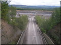

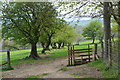
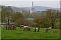
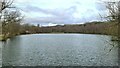


22 photos from this area
Area Information
Key information about the S33 9JT including its size, population, and administrative classification.
- Area Type
- Postcode
- Area Size
- 66.1 hectares
- Population
- 1787
- Population Density
- 74 people/km²
House Prices in S33 9JT
28
Properties
£306,250
Average Sold Price
£140,000
Lowest Price
£625,000
Highest Price
Showing 28 properties
| Address | Type | Beds | Baths | Last Sale Price | Last Sale Date | |
|---|---|---|---|---|---|---|
| Holly Tree Cottage, Stretfield Road, Bradwell, S33 9JT | Bungalow | - | - | £625,000 | Jan 2025 | |
| Black Bridge House, Stretfield Road, Bradwell, S33 9JT | Semi-detached | 2 | 1 | £240,000 | Sep 2024 | |
| Over The Top, Stretfield Road, Bradwell, S33 9JT | house | - | - | £140,000 | Mar 2018 | |
| Batham House, Stretfield Road, Bradwell, S33 9JT | Bungalow | - | - | £220,000 | May 2010 | |
| Meadows Farm, Eccles Lane, Bradwell, S33 9JT | Detached | - | - | - | - | |
| Caravan At, Blackbridge Farm, Stretfield Road, Bradwell, S33 9JT | Mobile Home | - | - | - | - | |
| Flat At, The Samuel Fox Inn, Stretfield Road, Bradwell, S33 9JT | Flat | - | - | - | - | |
| Blackbridge Farm, Stretfield Road, Bradwell, S33 9JT | Farm | - | - | - | - | |
| Unit 6 Container, Stretfield Mill, Unnamed Road At Stretfield Mill, Stretfield, Bradwell, S33 9JT | warehouse | - | - | - | - | |
| Unit 7 Container, Stretfield Mill, Unnamed Road At Stretfield Mill, Stretfield, Bradwell, S33 9JT | warehouse | - | - | - | - |
Page 1 of 3
Energy Efficiency in S33 9JT
Amenities
Schools
| Rank | School | Type | Entry gender | Ages |
|---|
Explore more schools in this area
Go to Schools tabDemographics
Household Size
Two person
most common
Accommodation Type
Houses
most common
Tenure
76
majority
Ethnic Group
White
most common
Religion
N/A
most common
Household Composition
N/A
most common
Age
47
median
Adults (30-64 years)
most common
Household Deprivation
N/A
with no deprivation
NS-SEC
37
in Lower managerial occupations
Explore more demographic insights in this area
Go to Demographics tabPlanning
Planning Constraints
- Flood RiskPremium
- Ramsar Wetland SitesPremium
- Area of Outstanding Natural BeautyPremium
- Protected Nature ReservePremium
- Protected WoodlandPremium