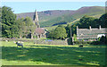
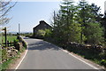
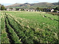
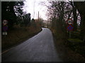
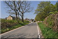
Area Overview for S33 7ZP
Photos of S33 7ZP


Area Information
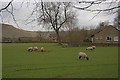
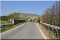
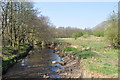
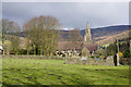
S33 7ZP occupies a specific postcode area covering a small residential cluster of 1.7 hectares. You will find 1,045 residents living within these boundaries, creating a compact neighbourhood with a population density of only 6 people per square kilometre. This low density defines the daily rhythm of life in S33 7ZP, offering a quiet environment far removed from the congestion of urban centres. The area is situated entirely in England, embodying a classic semi-rural residential setting. Prospective buyers should anticipate a lifestyle characterised by relative solitude and a strong sense of space. The limited footprint of 1.7 hectares means that the community is self-contained yet intimate. You can expect to know your neighbours quickly, as the low population density and small area size foster direct interactions. Living in S33 7ZP involves trading the immediate noise of busy streets for a peaceful atmosphere. This specific postcode cluster serves as a distinct pocket of habitation, ideal for those who value quiet over convenience. The almost vacant land ratio suggests an environment where nature and dwelling spaces coexist without clutter. Your days here will likely involve short commutes to nearby towns and ample time enjoying the open air surrounding your home.
- Area Type
- Postcode
- Area Size
- 1.7 hectares
- Population
- 1045
- Population Density
- 6 people/km²
Homes in S33 7ZP are almost exclusively houses, creating a consistent housing stock for potential buyers. The market here is fundamentally owner-occupied, with 81 per cent of properties belonging to their residents. This high ownership percentage means the local market moves slower than in rental-heavy districts. You are likely to find detached or semi-detached family homes rather than flats or apartments. The absence of flats aligns with the area's description of being a specific residential cluster focused on houses. Buying a home in S33 7ZP often feels like acquiring a piece of legacy rather than just a property. Prices may reflect the stability of the owner-occupier base, as sellers in this area tend to hold for longer periods. The uniformity of the housing type simplifies your search, as you know exactly what architectural styles you can expect. There are no competing housing typologies to confuse your view of the market value. The 100 per cent focus on houses means you do not need to consider leasehold issues or service charges common in flat developments. Your investment here is secure against market shifts that might affect high-density rental blocks.
House Prices in S33 7ZP
Showing 6 properties
| Address | Type | Beds | Baths | Last Sale Price | Last Sale Date | |
|---|---|---|---|---|---|---|
| 6, Railway Station Cottages, Unnamed Road From Hope Road To Stonecroft, Edale, S33 7ZP | house | - | - | £360,000 | Jun 2021 | |
| 5, Railway Station Cottages, Unnamed Road From Hope Road To Stonecroft, Edale, S33 7ZP | house | - | - | £310,000 | Dec 2020 | |
| 1, Railway Station Cottages, Unnamed Road From Hope Road To Stonecroft, Edale, S33 7ZP | house | - | - | £305,000 | Jun 2014 | |
| 4, Railway Station Cottages, Unnamed Road From Hope Road To Stonecroft, Edale, S33 7ZP | Terraced | - | - | - | - | |
| 2, Railway Station Cottages, Unnamed Road From Hope Road To Stonecroft, Edale, S33 7ZP | house | - | - | - | - | |
| 3, Quince Cottage, Railway Station Cottages, Unnamed Road From Hope Road To Stonecroft, Edale, S33 7ZP | house | - | - | - | - |
Energy Efficiency in S33 7ZP
Daily life in S33 7ZP revolves around convenient access to essential amenities within practical reach. Five railway stations serve the area, including Edale Railway Station, Hope Railway Station, and Dove Holes Railway Station. These rail links connect you to wider networks despite the rural feel of the postcode. Retail options include a Spar, Co-op Bradwell, and Aldi Chapel en le. You can handle weekly shopping and daily necessities without needing to travel far. The availability of these specific supermarkets ensures you do not rely exclusively on online grocery delivery. Living in S33 7ZP means you have the baseline comforts of a home, with shops located just minutes away. The five available retail outlets provide enough variety for standard family needs. You will find neither the vastness of city centres nor the complete isolation of hinterland villages. The combination of rail access and local shops creates a functional lifestyle where weekly trips are manageable. Convenience here is defined by essential availability rather than luxury shopping or entertainment hubs. Your daily routine balances the quiet of the residential cluster with the practicality of nearby services.
Amenities
Schools
Families living in S33 7ZP benefit from access to three recommended primary schools nearby. Castleton CofE Primary School holds a good Ofsted rating and serves as a local option for young children. Edale CofE Primary School also boasts a good Ofsted rating, providing another highly regarded educational choice in close proximity. Peak Forest Church of England Voluntary Controlled Primary School completes the trio of recommended institutions, also carrying a good Ofsted rating. You will not find secondary schools listed in the immediate educational data for this specific postcode cluster, meaning families often look slightly further afield for older children. The presence of three top-rated primary schools suggests a strong commitment to early education within the surrounding region. All three institutions are Church of England Voluntary Controlled or maintained, offering faith-based education alongside standard state schooling. The consistent 'good' rating across these three options indicates a reliable standard of education for residents. When buying homes in S33 7ZP, proximity to these specific schools adds significant value to your purchase.
| Rank | School | Type | Entry gender | Ages |
|---|
Explore more schools in this area
Go to Schools tabDemographics
The community in S33 7ZP is dominated by adults aged between 30 and 64 years old. The median age for residents stands at 47 years, confirming that this is a mature area rather than a hub for young families or students. Eighty-one per cent of homes in S33 7ZP are owner-occupied, indicating a stable, settled population with long-term roots. Almost all accommodation consists of houses, reinforcing the family-oriented and established nature of the neighbourhood. Predominantly white in terms of ethnicity, the demographic profile reflects a traditional settlement pattern common in many English suburbs. You will not find a transient or highly mobile population moving through this postcode regularly. The high ownership rate means most residents have tweaked their homes to suit their personal tastes over decades. This stability creates a predictable environment where neighbours respect one another's peace. With three-quarters of residents owning their homes, you are buying into a legacy of ownership rather than entering a high-turnover rental market. The age skew towards middle age suggests amenities with health services or quieter recreation centres are the primary appeals for current buyers.
Household Size
Accommodation Type
Tenure
Ethnic Group
Religion
Household Composition
Age
Household Deprivation
NS-SEC
Explore more demographic insights in this area
Go to Demographics tabPlanning
Planning Constraints
- Flood RiskPremium
- Ramsar Wetland SitesPremium
- Area of Outstanding Natural BeautyPremium
- Protected Nature ReservePremium
- Protected WoodlandPremium