Area Overview for S33 6SE
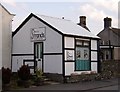
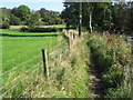
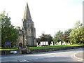
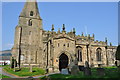
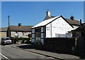
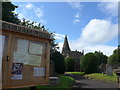
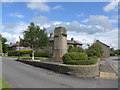
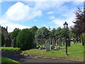
Photos of S33 6SE


Area Information
Postcode S33 6SE occupies a small residential cluster stretching across just over eight thousand square metres. This compact footprint supports a population of 1,122 people, creating a tight-knit environment where neighbours are likely to know one another. With a population density of 85 people per square kilometre, the area avoids the crushing congestion of dense city centres while maintaining easy access to local facilities. Living in S33 6SE means prioritising quiet streets and a sense of space without sacrificing convenience to the surrounding towns. The settlement functions as a self-contained residential pocket, ideal for those seeking a calm rhythm to their daily lives away from the noise of larger urban hubs. The area serves as a quiet outpost near the Peak District, offering a backdrop of natural beauty without being remote. Daily life here revolves around practical connectivity and community interaction rather than high-energy urban activity. Residents enjoy a setting where the pace is controlled, and the scale of development remains modest. This postcode represents a specific choice for individuals who value a grounded, residential atmosphere over the facilities of a major city centre. For anyone considering homes in S33 6SE, the environment promises stability and a clear focus on living rather than commuting.
- Area Type
- Postcode
- Area Size
- 8409 m²
- Population
- 1122
- Population Density
- 85 people/km²
The property market in S33 6SE is defined by a strong preference for ownership. With 70% of residents owning their homes, the area functions primarily as an owner-occupied zone rather than a rental market. This statistic suggests that houses in S33 6SE change hands at a slower rate, leading to a community with high residential stability. The accommodation type focuses almost exclusively on houses, meaning you will find traditional family properties rather than purpose-built blocks of flats or student accommodations. Buying a home here typically involves purchasing an established property within a small residential cluster. The limited size of the postcode, covering only 8,409 square metres, means that the total supply of homes is finite. This scarcity can create a competitive but exclusive market for those looking to secure a property in this specific cluster. Prospective buyers should expect to deal with conventional house sales rather than the rapid turnover common in buy-to-let hubs. The market reflects the maturity of the area, where price stability is often linked to the high percentage of owner-occupiers who tend to hold onto their properties for the long term.
House Prices in S33 6SE
Showing 13 properties
| Address | Type | Beds | Baths | Last Sale Price | Last Sale Date | |
|---|---|---|---|---|---|---|
| 12 Market Close, Hope, S33 6SE | Semi-detached | 2 | - | £225,000 | Jul 2025 | |
| 3 Market Close, Hope, S33 6SE | house | - | - | £215,000 | Sep 2023 | |
| 1 Market Close, Hope, S33 6SE | Terraced | - | - | £90,000 | Jul 2018 | |
| Win Hill View Cottage, Market Close, Hope, S33 6SE | Semi-detached | 2 | 1 | £190,000 | Oct 2017 | |
| 4 Market Close, Hope, S33 6SE | Terraced | - | - | £27,670 | Dec 2005 | |
| Fieldhead Cottage, 8 Market Close, Hope, S33 6SE | Land | - | - | - | - | |
| 11 Market Close, Hope, S33 6SE | Semi-detached | 2 | - | - | - | |
| Losehill View, 7 Market Close, Hope, S33 6SE | Terraced | - | - | - | - | |
| 6 Market Close, Hope, S33 6SE | Terraced | - | - | - | - | |
| 9 Market Close, Hope, S33 6SE | house | - | - | - | - |
Energy Efficiency in S33 6SE
Daily life in S33 6SE is centred on practical amenities within a short walking or driving distance. Residents have access to three retail locations, including Spar, Co-op Bradwell, and Co-op Tideswell. These supermarkets and convenience stores form the core of the local shopping environment, providing everything from groceries to household essentials without needing a long drive. The area is not a destination for luxury shopping or fine dining but serves the functional needs of local families effectively. Transport links connect the neighbourhood to wider opportunities through five nearby railway stations. Hope Railway Station, Bamford Railway Station, and Edale Railway Station are the key hubs referenced for residents travelling further afield. This rail access means you can commute to larger towns or cities without being tied to a car for every journey. The lifestyle here is one of quiet convenience. You have the necessities close by and the trains when you need to go further. This setup supports a balanced routine where day-to-day life feels simple and manageable. There are no flashy entertainment venues closer than the shops, but the area offers a peaceful environment where the town centre remains just a step away.
Amenities
Schools
Families living in S33 6SE have access to several educational institutions within close proximity. Hope Primary School holds a 'good' Ofsted rating and serves as a central educational choice for younger children in the immediate vicinity. Nearby families also attend Hope Valley College, which operates with both primary and academy status. The academy designation ensures that the institution follows national standards while maintaining local community links. These options provide a clear pathway for education from early years through to secondary levels. The presence of multiple school types, including a rated good academy and a primary school with positive feedback, indicates a supported local education network. You do not need to commute far to access quality schooling. The mix of primary and secondary options within the local cluster means that many children can grow up in S33 6SE and receive most of their education nearby. This reduces the burden on parents who might otherwise face long travel times or complex school-run logistics. The schools listed offer a grounded, accessible approach to education that fits well with the residential character of the postcode.
| Rank | School | Type | Entry gender | Ages |
|---|
Explore more schools in this area
Go to Schools tabDemographics
The community within S33 6SE reflects a mature demographic profile with a median age of 47 years. Adults between the ages of 30 and 64 years make up the most common age range, suggesting the area appeals strongly to family units and established professionals. Home ownership stands out as a defining characteristic of this neighbourhood. Seven out of ten residents own their homes, which accounts for 70% of the population. This high rate of ownership indicates a settled community with long-term residents rather than a transient influx of tenants. Houses form the predominant accommodation type, reinforcing the family-oriented nature of the settlement. The architectural stock consists mainly of detached or semi-detached properties rather than high-rise flats or apartments. The ethnic composition is predominantly White, mirroring the broader patterns of this part of Derbyshire. There is no evidence of significant urban deprivation or high stress markers within the community statistics. The demographic data points to a stable, owner-occupied environment where families have put down roots. You are likely to encounter neighbours who have lived in this postcode for many years, creating a reliable social fabric.
Household Size
Accommodation Type
Tenure
Ethnic Group
Religion
Household Composition
Age
Household Deprivation
NS-SEC
Explore more demographic insights in this area
Go to Demographics tabPlanning
Planning Constraints
- Flood RiskPremium
- Ramsar Wetland SitesPremium
- Area of Outstanding Natural BeautyPremium
- Protected Nature ReservePremium
- Protected WoodlandPremium