Area Overview for S33 0AQ
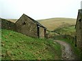
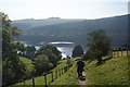
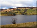
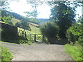
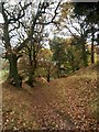
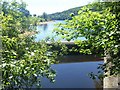
Photos of S33 0AQ
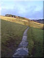
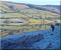
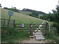
![Footpath leaves the road [1] in S33 0AQ](https://images.propbar.co.uk/images/geograph/58/41/5841350_120.jpg)
100 photos from this area
Area Information
Key information about the S33 0AQ including its size, population, and administrative classification.
- Area Type
- Postcode
- Area Size
- 11.4 km²
- Population
- 1045
- Population Density
- 6 people/km²
House Prices in S33 0AQ
13
Properties
£499,950
Average Sold Price
£499,950
Lowest Price
£499,950
Highest Price
Showing 13 properties
| Address | Type | Beds | Baths | Last Sale Price | Last Sale Date | |
|---|---|---|---|---|---|---|
| Derwent Lodge, Derwent Lane, Derwent, Bamford, S33 0AQ | Semi-detached | - | - | £499,950 | Nov 2002 | |
| 2, Jubilee Cottages, Derwent Lane, Derwent, Bamford, S33 0AQ | Terraced | 3 | 1 | - | - | |
| Old House, Derwent Lane, Derwent, Bamford, S33 0AQ | house | - | - | - | - | |
| Ashes Farm, Unnamed Road From A 57 To Derwent Lane, Derwent, Bamford, S33 0AQ | Detached | - | - | - | - | |
| Crookhill Barn, Unnamed Road Leading To Crookhill Farm, Derwent, Bamford, S33 0AQ | hotel | - | - | - | - | |
| High House Farm, Unnamed Road From A 57 To Derwent Lane, Derwent, Bamford, S33 0AQ | Detached | - | - | - | - | |
| St Henrys, Derwent Lane, Derwent, Bamford, S33 0AQ | house | - | - | - | - | |
| Derwent Cottage, Derwent Lane, Derwent, Bamford, S33 0AQ | house | - | - | - | - | |
| Crookhill Farm, Unnamed Road Leading To Crookhill Farm, Derwent, Bamford, S33 0AQ | house | - | - | - | - | |
| Shooting Lodge, Derwent Lane, Derwent, Bamford, S33 0AQ | house | - | - | - | - |
Page 1 of 2
Energy Efficiency in S33 0AQ
Amenities
Schools
| Rank | School | Type | Entry gender | Ages |
|---|
Explore more schools in this area
Go to Schools tabDemographics
Household Size
Two person
most common
Accommodation Type
Houses
most common
Tenure
81
majority
Ethnic Group
White
most common
Religion
N/A
most common
Household Composition
N/A
most common
Age
47
median
Adults (30-64 years)
most common
Household Deprivation
N/A
with no deprivation
NS-SEC
42
in Lower managerial occupations
Explore more demographic insights in this area
Go to Demographics tabPlanning
Planning Constraints
- Flood RiskPremium
- Ramsar Wetland SitesPremium
- Area of Outstanding Natural BeautyPremium
- Protected Nature ReservePremium
- Protected WoodlandPremium