Area Overview for S32 1AN
Photos of S32 1AN
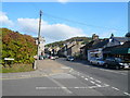
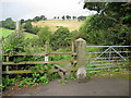
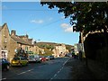
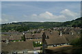
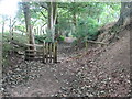
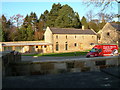
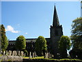
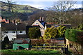
104 photos from this area
Area Information
Key information about the S32 1AN including its size, population, and administrative classification.
- Area Type
- Postcode
- Area Size
- 9943 m²
- Population
- 1607
- Population Density
- 135 people/km²
House Prices in S32 1AN
31
Properties
£247,647
Average Sold Price
£75,000
Lowest Price
£401,500
Highest Price
Showing 31 properties
| Address | Type | Beds | Baths | Last Sale Price | Last Sale Date | |
|---|---|---|---|---|---|---|
| Ashleigh, Crossland Road, Hathersage, S32 1AN | Detached | 3 | 1 | £159,000 | Sep 2021 | |
| 11 Crossland Road, Hathersage, S32 1AN | house | - | - | £401,500 | Jun 2021 | |
| 5 Crossland Road, Hathersage, S32 1AN | house | - | - | £335,000 | May 2021 | |
| 6 Crossland Road, Hathersage, S32 1AN | house | - | - | £395,000 | Feb 2020 | |
| 2, Calton Leys, Crossland Road, Hathersage, S32 1AN | Terraced | 6 | 1 | £290,000 | Nov 2019 | |
| 14 Crossland Road, Hathersage, S32 1AN | house | - | - | £320,000 | Mar 2018 | |
| 4 Crossland Road, Hathersage, S32 1AN | Terraced | 4 | 1 | £385,000 | Feb 2017 | |
| 1, Calton Leys, Crossland Road, Hathersage, S32 1AN | Terraced | 3 | 2 | £333,500 | May 2015 | |
| Leam View, Crossland Road, Hathersage, S32 1AN | house | - | - | £270,000 | Aug 2012 | |
| 7 Crossland Road, Hathersage, S32 1AN | Terraced | - | - | £300,000 | Mar 2012 |
Page 1 of 4
Energy Efficiency in S32 1AN
Amenities
Schools
| Rank | School | Type | Entry gender | Ages |
|---|
Explore more schools in this area
Go to Schools tabDemographics
Household Size
Two person
most common
Accommodation Type
Houses
most common
Tenure
87
majority
Ethnic Group
White
most common
Religion
N/A
most common
Household Composition
N/A
most common
Age
47
median
Adults (30-64 years)
most common
Household Deprivation
N/A
with no deprivation
NS-SEC
59
in Lower managerial occupations
Explore more demographic insights in this area
Go to Demographics tabPlanning
Planning Constraints
- Flood RiskPremium
- Ramsar Wetland SitesPremium
- Area of Outstanding Natural BeautyPremium
- Protected Nature ReservePremium
- Protected WoodlandPremium