Area Overview for S30 2SB
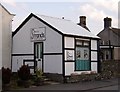
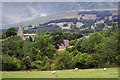
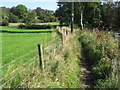
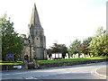
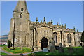
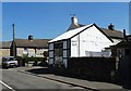
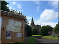
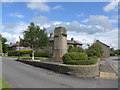
Photos of S30 2SB


Area Information
Living in S30 2SB offers a distinct experience typical of a small residential cluster in the English countryside. This postcode covers a specific area with a population of just over 1,100 residents, creating a quiet and manageable community environment. The low population density of 85 people per square kilometre means houses are set back from the road and offer plenty of green space. Most people here prefer the peace and quiet of life away from a large urban centre. Daily life revolves around local neighbours and access to nearby town centres rather than high street shopping here itself. You will find a community that values space and tranquility over the noise of city living. The area is situated within a county that provides easy access to the Peak District, making it ideal for those who enjoy outdoor activities. Shopping and commuting involves journeys to nearby hubs like Hope or Brasside, rather than walking down a local high street. This setting appeals to those seeking a slower pace while maintaining connection to essential services within a reasonable drive. The character of the area is defined by its semi-rural location, offering a retreat from the rush of daily commutes without complete isolation. You can expect a stable, friendly neighbourhood where residents know each other and local issues are discussed openly. The compact nature of the postcode means anything you need is either on your doorstep or a short drive away.
- Area Type
- Postcode
- Area Size
- Not available
- Population
- 1122
- Population Density
- 85 people/km²
The property market in S30 2SB is characterised by a predominantly owner-occupied stock, with 70% of homes held by their owners. This high ownership rate contrasts sharply with major cities where rental demand often drives market dynamics. The accommodation type is almost exclusively houses, meaning you will not find typical city-style apartments or high-rise flats within this postcode. Developing buildings or new construction is unlikely here due to the established nature of the housing stock and the rural setting. Most homes are likely to be family-sized properties suited to the needs of the 30-64 age bracket that dominates the area. Buyers looking at this area should expect to purchase an existing home rather than rent first or build new. homes in S30 2SB generally reflect the preferences of mature families who value space and garden areas over urban location. The small population of just 1,122 residents limits the supply available, which can affect pricing relative to supply and demand. Competition for suitable properties may be moderate given the specific requirements of the local demographic. If you are considering buying, you will find a market focused on traditional family housing rather than the diverse units found in metropolitan centres. The stability of the market comes from the entrenched presence of owner-occupiers who are unlikely to move frequently. You should be prepared for a market where sellers often stay in their homes for many years, leading to lower transaction volumes.
House Prices in S30 2SB
No properties found in this postcode.
Energy Efficiency in S30 2SB
Your daily lifestyle in S30 2SB revolves around convenience delivered by nearby amenities rather than local high streets. For shopping essentials, you have three main retail options close by, including Spar, Co-op Bradwell, and Co-op Tideswell. These supermarkets provide everything you need from groceries to household supplies without a long drive. Travel connections are supported by five nearby railway stations, ensuring you can reach larger towns with a short train ride. Closest to you are Hope Railway Station, Bamford Railway Station, and Edale Railway Station, all of which provide access to wider transport networks. While there are no mentioned parks or leisure centres directly inside the postcode, the area's rural setting implies ample outdoor space for walking and exercise. The character of the area is defined by its proximity to these transport hubs rather than on-site attractions. Dining options are not explicitly listed for this specific postcode, suggesting you may cook at home or visit the nearby villages for restaurant meals. Leisure activities likely focus on hiking and exploring the natural surroundings of the local district. The convenience of having multiple supermarket options and several train stations makes practical life manageable despite the rural location. You can run errands locally and still enjoy the peace of living away from a busy town centre.
Amenities
Schools
Families considering schools near S30 2SB have access to a small number of educational institutions within the local vicinity. The nearest primary education options include Hope Primary School, which currently holds a good Ofsted rating, providing a solid foundation for younger children. Another option in the immediate area is also listed as Hope Valley College, though this entry requires clarification as it is a primary school name not typically associated with college status. For secondary or further education needs, there is Hope Valley College listed as an academy with a good Ofsted rating, serving students in the surrounding wider authority. The mix of school types is limited, meaning there are few choices directly within this tiny postcode border. You will likely need to look slightly further afield for top-tier secondary education options or large comprehensive academies. The presence of a well-regarded primary school like Hope Primary School is a positive factor for those with young children just starting their education journey. Families with older children may travel to Hope Valley College for their secondary education. The limited number of schools suggests a community designed around small, localised attendance rather than large district-wide schools. Parents must plan carefully regarding travel times to ensure their children reach these specific institutions.
| Rank | School | Type | Entry gender | Ages |
|---|
Explore more schools in this area
Go to Schools tabDemographics
The community in S30 2SB reflects a mature demographic profile dominated by adults between the ages of 30 and 64 years. The median age stands at 47 years, indicating that families here often consist of parents settled in their careers and adult children. Home ownership is the norm, with 70% of properties owned by their occupants rather than rented. This high rate of ownership suggests financial stability and long-term commitment to the locality. The predominant accommodation type consists of houses, reinforcing the family-oriented nature of the neighbourhood. You will find that semi-detached and detached homes are the standard, with flats being exceptionally rare in this specific area. The ethnic makeup is predominantly White, which mirrors the broader demographics found in many rural and semi-rural parts of the north of England. There is a notable absence of younger residents under the age of 30, alongside very few elderly residents over 65 living here. This age range suggests a workforce-age population that balances young families with established couples. The social fabric appears stable, driven by households that have put down roots and prioritize community engagement. Low deprivation levels are implied by the high home ownership rate and mature workforce, pointing to a reasonably affluent compared to the national average. Residents value stability and have chosen this location to raise their families and settle down permanently.
Household Size
Accommodation Type
Tenure
Ethnic Group
Religion
Household Composition
Age
Household Deprivation
NS-SEC
Explore more demographic insights in this area
Go to Demographics tabPlanning
Planning Constraints
- Flood RiskPremium
- Ramsar Wetland SitesPremium
- Area of Outstanding Natural BeautyPremium
- Protected Nature ReservePremium
- Protected WoodlandPremium