Area Overview for S18 9DR
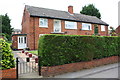
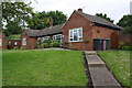
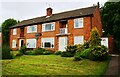
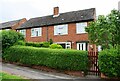
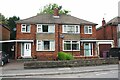
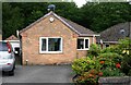
Photos of S18 9DR


Area Information
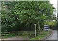
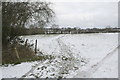
S18 9DR is a specific postcode area covering a small residential cluster in Derbyshire. This compact location holds a population of 1,359 people, creating a close-knit community environment. With a population density of 1,054 people per square kilometre, the area feels settled rather than sprawling. Living in S18 9DR means relying on a well-defined neighbourhood structure where local amenities are within practical reach. The area sits near key transport hubs like Dronfield Railway Station and Chesterfield Railway Station, which sit just beyond the immediate cluster. Daily life here centres on stability and proximity to established services. You will find yourself in a setting where large developments are absent, allowing for a quiet residential atmosphere. The location benefits from low flood risk and no protected planning constraints, making it a practical choice for families. The density suggests you will not be isolated, yet the small cluster size ensures the area retains a sense of individual character. This postcode is defined by its proximity to Dronfield and its integration into the wider rural-suburban fabric of the region.
- Area Type
- Postcode
- Area Size
- Not available
- Population
- 1359
- Population Density
- 1054 people/km²
The property market in S18 9DR is characterised by a mix of owner-occupiers and renters. Just under half of the households own their homes, a figure of 48%. This suggests a balanced market where both first-time buyers and long-term investors find a foothold. Houses are the predominant accommodation type, indicating that the housing stock consists of detached, semi-detached, or terraced family homes rather than apartments or purpose-built retirement flats. Buying a home here means entering a market focused on traditional brick and stone properties typical of the English landscape. The small population of 1,359 limits large-scale speculative development, keeping prices相对稳定. You will find that the market responds more to local demand than external investment trends. The density of 1,054 people per square kilometre ensures that the area remains walkable yet retains a suburban feel. Prospective buyers should expect a straightforward purchase process within a stable, established community where property values are driven by local factors.
House Prices in S18 9DR
No properties found in this postcode.
Energy Efficiency in S18 9DR
Residents of S18 9DR benefit from a variety of amenities within practical reach. Retail options include Morrisons Daily, Co-op Dronfield, and a Spar, providing essential shopping needs without requiring a long commute. Transport links are extensive with five rail stations nearby, including Dronfield Railway Station, Dore & Totley Railway Station, and Chesterfield Railway Station. Five metro platforms such as Herdings Park Platform and Herdings also serve the area. A coach station is available for bus services, adding another layer of flexibility for travel. These specific venues make daily errands and leisure trips convenient. The area offers a balanced lifestyle where local shops handle basics and trains handle longer journeys. You can walk to your local supermarket or catch a train to Chesterfield with minimal effort. This blend of convenience and connectivity defines the character of life in this specific postcode area.
Amenities
Schools
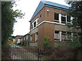
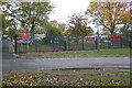
Families living in S18 9DR have access to three primary schools, all rated good by Ofsted. Holmesdale Infant School serves young children with a good rating. Dronfield Stonelow Junior School also holds a good rating and caters to younger pupils moving up from infant classes. Dronfield Henry Fanshawe School completes the trio of educational options in the immediate vicinity. This mix of single-sex infant and junior sections allows children to attend various schools within a short distance from their homes. The consistent good ratings across these three institutions provide reassurance for parents regarding educational quality. You do not need to travel far to secure a place for your children in this type of school. The presence of these specific schools near S18 9DR ensures that education remains a central, accessible part of community life.
| Rank | School | Type | Entry gender | Ages |
|---|
Explore more schools in this area
Go to Schools tabDemographics
The community in S18 9DR is defined by a mature age profile. The median age sits at 47 years, with adults aged between 30 and 64 years representing the most common age range. This indicates an area dominated by established families and older households rather than young professionals or retirees. Home ownership stands at 48%, meaning nearly half of the residents own their property outright or have a mortgage. The other half likely rents or accesses accommodation through other means. Houses form the primary accommodation type, reflecting a traditional housing stock rather than high-rise flats or purpose-built blocks. The predominant ethnic group is White, which aligns with the broader demographic trends of this part of Derbyshire. There are no indications of significant deprivation affecting the daily quality of life based on the available data. The population mix suggests a stable, long-term community where residents have likely put down deep roots in the neighbourhood.
Household Size
Accommodation Type
Tenure
Ethnic Group
Religion
Household Composition
Age
Household Deprivation
NS-SEC
Explore more demographic insights in this area
Go to Demographics tabPlanning
Planning Constraints
- Flood RiskPremium
- Ramsar Wetland SitesPremium
- Area of Outstanding Natural BeautyPremium
- Protected Nature ReservePremium
- Protected WoodlandPremium