Area Overview for S18 2XL
Photos of S18 2XL
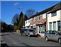


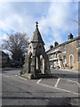


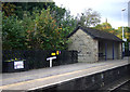

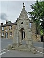
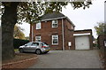
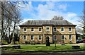
84 photos from this area
Area Information
Key information about the S18 2XL including its size, population, and administrative classification.
- Area Type
- Postcode
- Area Size
- 2.9 hectares
- Population
- 1359
- Population Density
- 1054 people/km²
House Prices in S18 2XL
22
Properties
£327,250
Average Sold Price
£49,000
Lowest Price
£600,000
Highest Price
Showing 22 properties
| Address | Type | Beds | Baths | Last Sale Price | Last Sale Date | |
|---|---|---|---|---|---|---|
| 1 Mill Lane, Dronfield, S18 2XL | Terraced | 2 | 2 | £600,000 | Apr 2022 | |
| Tap Cottage, Mill Lane, Dronfield, S18 2XL | Detached | 4 | 2 | £480,000 | Dec 2021 | |
| 3 Mill Lane, Dronfield, S18 2XL | Semi-detached | - | - | £180,000 | Nov 2007 | |
| 2 Mill Lane, Dronfield, S18 2XL | Semi-detached | - | - | £49,000 | Aug 1998 | |
| One To One Tutors, Bridge House, Mill Lane, Dronfield, S18 2XL | Office | - | - | - | - | |
| Danerock Limited, Bridge House, Mill Lane, Dronfield, S18 2XL | Office | - | - | - | - | |
| Unit 12A, Bridge House, Mill Lane, Dronfield, S18 2XL | shop | - | - | - | - | |
| Bashmoor Ltd, Studio 14, Riverside Studios, Mill Lane, Dronfield, S18 2XL | Office | - | - | - | - | |
| Co-efficient Renewable Heating Solutions Ltd, Studio 17, Riverside Studios, Mill Lane, Dronfield, S18 2XL | Office | - | - | - | - | |
| Nationwide Business Finance Limited, Bridge House, Mill Lane, Dronfield, S18 2XL | Office | - | - | - | - |
Page 1 of 3
Energy Efficiency in S18 2XL
Amenities
Schools
| Rank | School | Type | Entry gender | Ages |
|---|
Explore more schools in this area
Go to Schools tabDemographics
Household Size
One person
most common
Accommodation Type
Houses
most common
Tenure
48
majority
Ethnic Group
White
most common
Religion
N/A
most common
Household Composition
N/A
most common
Age
47
median
Adults (30-64 years)
most common
Household Deprivation
N/A
with no deprivation
NS-SEC
30
in Lower managerial occupations
Explore more demographic insights in this area
Go to Demographics tabPlanning
Planning Constraints
- Flood RiskPremium
- Ramsar Wetland SitesPremium
- Area of Outstanding Natural BeautyPremium
- Protected Nature ReservePremium
- Protected WoodlandPremium