Area Overview for S18 2LY
Photos of S18 2LY
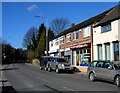

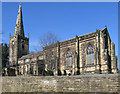
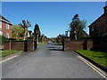
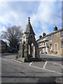
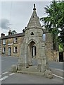
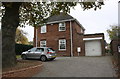
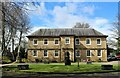
84 photos from this area
Area Information
Key information about the S18 2LY including its size, population, and administrative classification.
- Area Type
- Postcode
- Area Size
- 3.6 hectares
- Population
- 1359
- Population Density
- 1054 people/km²
House Prices in S18 2LY
27
Properties
£163,538
Average Sold Price
£35,500
Lowest Price
£585,000
Highest Price
Showing 27 properties
| Address | Type | Beds | Baths | Last Sale Price | Last Sale Date | |
|---|---|---|---|---|---|---|
| 2 Princess Road, Dronfield, S18 2LY | Terraced | 2 | 1 | £585,000 | May 2024 | |
| 36 Princess Road, Dronfield, S18 2LY | Terraced | 2 | 1 | £150,000 | May 2024 | |
| 46 Princess Road, Dronfield, S18 2LY | Terraced | 2 | 1 | £152,500 | Jul 2019 | |
| 22 Princess Road, Dronfield, S18 2LY | Semi-detached | 2 | 1 | £112,000 | Dec 2017 | |
| 10 Princess Road, Dronfield, S18 2LY | Semi-detached | 3 | - | £240,000 | May 2014 | |
| 32 Princess Road, Dronfield, S18 2LY | Semi-detached | 2 | - | £150,000 | Apr 2014 | |
| 48 Princess Road, Dronfield, S18 2LY | Terraced | 2 | 1 | £116,500 | Oct 2013 | |
| 14 Princess Road, Dronfield, S18 2LY | house | 4 | - | £202,500 | Jul 2012 | |
| 24 Princess Road, Dronfield, S18 2LY | house | - | - | £120,000 | Apr 2011 | |
| 40 Princess Road, Dronfield, S18 2LY | Terraced | 1 | 1 | £100,000 | Apr 2010 |
Page 1 of 3
Energy Efficiency in S18 2LY
Amenities
Schools
| Rank | School | Type | Entry gender | Ages |
|---|
Explore more schools in this area
Go to Schools tabDemographics
Household Size
One person
most common
Accommodation Type
Houses
most common
Tenure
48
majority
Ethnic Group
White
most common
Religion
N/A
most common
Household Composition
N/A
most common
Age
47
median
Adults (30-64 years)
most common
Household Deprivation
N/A
with no deprivation
NS-SEC
30
in Lower managerial occupations
Explore more demographic insights in this area
Go to Demographics tabPlanning
Planning Constraints
- Flood RiskPremium
- Ramsar Wetland SitesPremium
- Area of Outstanding Natural BeautyPremium
- Protected Nature ReservePremium
- Protected WoodlandPremium