Area Overview for S18 2GZ
Photos of S18 2GZ
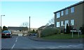
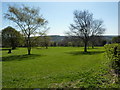
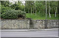
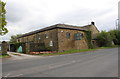
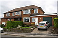
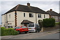
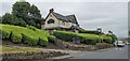
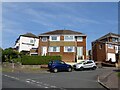
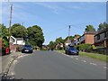
34 photos from this area
Area Information
Key information about the S18 2GZ including its size, population, and administrative classification.
- Area Type
- Postcode
- Area Size
- 2.6 hectares
- Population
- 1430
- Population Density
- 1765 people/km²
House Prices in S18 2GZ
46
Properties
£247,373
Average Sold Price
£79,500
Lowest Price
£490,000
Highest Price
Showing 46 properties
| Address | Type | Beds | Baths | Last Sale Price | Last Sale Date | |
|---|---|---|---|---|---|---|
| 50 Summerfield Road, Dronfield, S18 2GZ | Detached | 3 | 1 | £330,100 | Mar 2025 | |
| 53 Summerfield Road, Dronfield, S18 2GZ | Detached | 3 | 1 | £305,000 | Feb 2025 | |
| 15 Summerfield Road, Dronfield, S18 2GZ | Detached | 3 | 2 | £330,200 | Mar 2024 | |
| 24 Summerfield Road, Dronfield, S18 2GZ | Bungalow | 3 | - | £342,000 | Sep 2023 | |
| 35 Summerfield Road, Dronfield, S18 2GZ | Detached | 4 | 2 | £365,000 | Mar 2023 | |
| 34 Summerfield Road, Dronfield, S18 2GZ | Retail | 3 | 1 | £320,000 | Sep 2022 | |
| 5 Summerfield Road, Dronfield, S18 2GZ | Retail | 4 | 2 | £490,000 | Aug 2022 | |
| 44 Summerfield Road, Dronfield, S18 2GZ | Detached | 3 | 1 | £320,000 | Jul 2022 | |
| 27 Summerfield Road, Dronfield, S18 2GZ | house | - | - | £277,500 | Apr 2022 | |
| 31 Summerfield Road, Dronfield, S18 2GZ | Retail | 5 | 3 | £420,000 | Feb 2022 |
Page 1 of 5
Energy Efficiency in S18 2GZ
Amenities
Schools
| Rank | School | Type | Entry gender | Ages |
|---|
Explore more schools in this area
Go to Schools tabDemographics
Household Size
Two person
most common
Accommodation Type
Houses
most common
Tenure
85
majority
Ethnic Group
White
most common
Religion
N/A
most common
Household Composition
N/A
most common
Age
47
median
Adults (30-64 years)
most common
Household Deprivation
N/A
with no deprivation
NS-SEC
39
in Lower managerial occupations
Explore more demographic insights in this area
Go to Demographics tabPlanning
Planning Constraints
- Flood RiskPremium
- Ramsar Wetland SitesPremium
- Area of Outstanding Natural BeautyPremium
- Protected Nature ReservePremium
- Protected WoodlandPremium