Area Overview for S18 1RX
Photos of S18 1RX
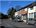
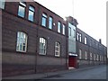
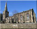
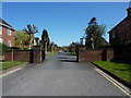
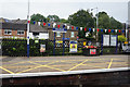
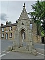
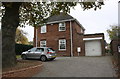
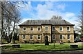
84 photos from this area
Area Information
Key information about the S18 1RX including its size, population, and administrative classification.
- Area Type
- Postcode
- Area Size
- 2.3 hectares
- Population
- 1551
- Population Density
- 2560 people/km²
House Prices in S18 1RX
46
Properties
£159,644
Average Sold Price
£54,000
Lowest Price
£231,000
Highest Price
Showing 46 properties
| Address | Type | Beds | Baths | Last Sale Price | Last Sale Date | |
|---|---|---|---|---|---|---|
| 46 Fletcher Avenue, Dronfield, S18 1RX | house | - | - | £231,000 | Aug 2022 | |
| 10 Fletcher Avenue, Dronfield, S18 1RX | house | - | - | £195,000 | Jan 2021 | |
| 92 Fletcher Avenue, Dronfield, S18 1RX | house | 2 | 1 | £162,000 | Nov 2020 | |
| 22 Fletcher Avenue, Dronfield, S18 1RX | Semi-detached | 2 | 1 | £150,000 | Feb 2020 | |
| 16 Fletcher Avenue, Dronfield, S18 1RX | Semi-detached | 3 | 1 | £202,000 | Oct 2019 | |
| 36 Fletcher Avenue, Dronfield, S18 1RX | Semi-detached | 3 | 2 | £200,000 | Mar 2019 | |
| 2 Fletcher Avenue, Dronfield, S18 1RX | Semi-detached | 3 | 1 | £203,000 | Oct 2018 | |
| 28 Fletcher Avenue, Dronfield, S18 1RX | house | - | - | £148,000 | Jun 2016 | |
| 72 Fletcher Avenue, Dronfield, S18 1RX | Semi-detached | 4 | - | £175,000 | Oct 2014 | |
| 48 Fletcher Avenue, Dronfield, S18 1RX | Semi-detached | 4 | - | £165,000 | Oct 2014 |
Page 1 of 5
Energy Efficiency in S18 1RX
Amenities
Schools
| Rank | School | Type | Entry gender | Ages |
|---|
Explore more schools in this area
Go to Schools tabDemographics
Household Size
One person
most common
Accommodation Type
Houses
most common
Tenure
64
majority
Ethnic Group
White
most common
Religion
N/A
most common
Household Composition
N/A
most common
Age
47
median
Adults (30-64 years)
most common
Household Deprivation
N/A
with no deprivation
NS-SEC
37
in Lower managerial occupations
Explore more demographic insights in this area
Go to Demographics tabPlanning
Planning Constraints
- Flood RiskPremium
- Ramsar Wetland SitesPremium
- Area of Outstanding Natural BeautyPremium
- Protected Nature ReservePremium
- Protected WoodlandPremium