Area Overview for S18 1PW
Photos of S18 1PW
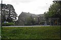
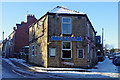
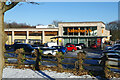
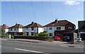
28 photos from this area
Area Information
Key information about the S18 1PW including its size, population, and administrative classification.
- Area Type
- Postcode
- Area Size
- 2.1 hectares
- Population
- 1411
- Population Density
- 1345 people/km²
House Prices in S18 1PW
25
Properties
£210,332
Average Sold Price
£53,000
Lowest Price
£373,250
Highest Price
Showing 25 properties
| Address | Type | Beds | Baths | Last Sale Price | Last Sale Date | |
|---|---|---|---|---|---|---|
| 20 Beechwood Road, Dronfield, S18 1PW | Detached | 2 | 1 | £285,000 | Oct 2025 | |
| 10 Beechwood Road, Dronfield, S18 1PW | Detached | 3 | 2 | £373,250 | Sep 2025 | |
| 26 Beechwood Road, Dronfield, S18 1PW | Detached | 3 | 1 | £330,000 | Sep 2025 | |
| 15 Beechwood Road, Dronfield, S18 1PW | Bungalow | 3 | 1 | £245,000 | Aug 2024 | |
| 21 Beechwood Road, Dronfield, S18 1PW | Bungalow | - | - | £312,500 | May 2022 | |
| 32 Beechwood Road, Dronfield, S18 1PW | Bungalow | - | - | £290,000 | Sep 2021 | |
| 11 Beechwood Road, Dronfield, S18 1PW | Bungalow | - | - | £252,000 | Sep 2021 | |
| 6 Beechwood Road, Dronfield, S18 1PW | Bungalow | 3 | - | £200,000 | Sep 2015 | |
| 23 Beechwood Road, Dronfield, S18 1PW | house | - | - | £163,000 | Nov 2009 | |
| 14 Beechwood Road, Dronfield, S18 1PW | Detached | - | - | £170,000 | Oct 2008 |
Page 1 of 3
Energy Efficiency in S18 1PW
Amenities
Schools
| Rank | School | Type | Entry gender | Ages |
|---|
Explore more schools in this area
Go to Schools tabDemographics
Household Size
Two person
most common
Accommodation Type
Houses
most common
Tenure
92
majority
Ethnic Group
White
most common
Religion
N/A
most common
Household Composition
N/A
most common
Age
47
median
Adults (30-64 years)
most common
Household Deprivation
N/A
with no deprivation
NS-SEC
45
in Lower managerial occupations
Explore more demographic insights in this area
Go to Demographics tabPlanning
Planning Constraints
- Flood RiskPremium
- Ramsar Wetland SitesPremium
- Area of Outstanding Natural BeautyPremium
- Protected Nature ReservePremium
- Protected WoodlandPremium