Area Overview for S18 1PH
Photos of S18 1PH
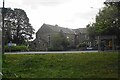
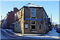
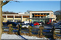
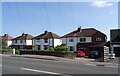
28 photos from this area
Area Information
Key information about the S18 1PH including its size, population, and administrative classification.
- Area Type
- Postcode
- Area Size
- 2.2 hectares
- Population
- 2266
- Population Density
- 3180 people/km²
House Prices in S18 1PH
29
Properties
£155,691
Average Sold Price
£41,500
Lowest Price
£399,970
Highest Price
Showing 29 properties
| Address | Type | Beds | Baths | Last Sale Price | Last Sale Date | |
|---|---|---|---|---|---|---|
| 98 Stubley Lane, Dronfield, S18 1PH | Terraced | 3 | 1 | £203,000 | Oct 2025 | |
| 106 Stubley Lane, Dronfield, S18 1PH | Terraced | 3 | 1 | £165,000 | Oct 2020 | |
| 140 Stubley Lane, Dronfield, S18 1PH | Terraced | 3 | 1 | £149,250 | May 2018 | |
| 138 Stubley Lane, Dronfield, S18 1PH | Terraced | 3 | - | £118,500 | Dec 2013 | |
| 144 Stubley Lane, Dronfield, S18 1PH | house | - | - | £130,000 | Oct 2013 | |
| 152 Stubley Lane, Dronfield, S18 1PH | Detached | - | - | £399,970 | Oct 2008 | |
| 102 Stubley Lane, Dronfield, S18 1PH | Terraced | - | - | £122,000 | Nov 2007 | |
| 146 Stubley Lane, Dronfield, S18 1PH | Terraced | 3 | - | £72,000 | Apr 2003 | |
| 108 Stubley Lane, Dronfield, S18 1PH | house | - | - | £41,500 | Oct 1997 | |
| 150 Stubley Lane, Dronfield, S18 1PH | house | - | - | - | - |
Page 1 of 3
Energy Efficiency in S18 1PH
Amenities
Schools
| Rank | School | Type | Entry gender | Ages |
|---|
Explore more schools in this area
Go to Schools tabDemographics
Household Size
Family (3-5 people)
most common
Accommodation Type
Houses
most common
Tenure
78
majority
Ethnic Group
White
most common
Religion
N/A
most common
Household Composition
N/A
most common
Age
47
median
Adults (30-64 years)
most common
Household Deprivation
N/A
with no deprivation
NS-SEC
38
in Lower managerial occupations
Explore more demographic insights in this area
Go to Demographics tabPlanning
Planning Constraints
- Flood RiskPremium
- Ramsar Wetland SitesPremium
- Area of Outstanding Natural BeautyPremium
- Protected Nature ReservePremium
- Protected WoodlandPremium