Area Overview for Ryhall & Casterton Ward
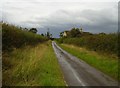
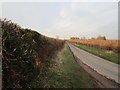
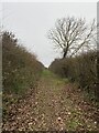
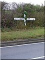
Photos of Ryhall & Casterton Ward
Area Information
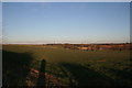
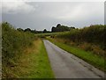
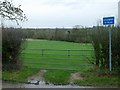
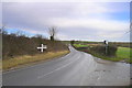
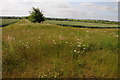
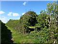
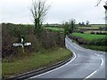
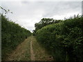
Ryhall & Casterton Ward sits within the unitary authority of Rutland County Council in the East Midlands. This district spans 36.3 km², containing the villages of Ryhall and Casterton with a population of approximately 2,927 residents. Life here moves at a slower pace than in larger towns, yet it remains firmly connected to modern standards of living. The ward offers a quiet rural setting without compromising on accessibility to regional amenities. Prospective homebuyers often seek this location for its stability and community cohesion rather than for high-density urban features. You will find a neighbourhood defined by its village green heritage and agricultural surroundings. The area functions as a self-contained community where local governance through Rutland County Council maintains direct oversight of local services. Living in Ryhall & Casterton Ward means embracing a lifestyle characterised by low population density. The ward represents a typical Rutland experience where proximity to nature is immediate. While the area lacks the major transport hubs of the wider East Midlands, its internal connectivity supports daily needs effectively. The sense of place is grounded in specific landmarks and village centres. For those considering Ryhall & Casterton Ward, the scale of the area ensures that local issues remain personal and manageable. This ward provides a stable environment where residents know their neighbours and understand the local landscape. The total area size of 36.3 km² limits rapid expansion, preserving the existing character of both Ryhall and Casterton.
- Area Type
- District Borough Unitary Ward
- Area Size
- 36.3 km²
- Population
- Not available
- Population Density
- Not available
Demographics
The demographic profile of Ryhall & Casterton Ward reflects a mature community driving home affordability and stability. The median age stands at 70 years, indicating an older population structure compared to the national average. Most residents fall into the older age categories, creating a quiet atmosphere where traditional values often shape local interactions. Home ownership is exceptionally high at 77%, meaning that nearly four out of five households own their properties outright or with a mortgage. This high level of tenure stability suggests that many families have deep roots in the ward and plan to remain long-term. The demographic data also reveals that household composition and accommodation types adhere to patterns common in rural English counties. You are likely to encounter a mix of detached and semi-detached properties suited to larger households. The predominant ethnic group and religious affiliation follow typical national trends for this demographic, as specific figures for these categories were not detailed in the available records. Deprivation is not explicitly quantified in the provided statistics, but the high home ownership rate inversely suggests financial security within the area. This community leans heavily on long-term residents rather than transient populations. The age profile directly influences local service demand, with a focus on healthcare and leisure activities suitable for seniors rather than youth-oriented facilities. When you consider homes in Ryhall & Casterton Ward, you are entering a neighbourhood where generational continuity defines the social fabric.
Household Size
Accommodation Type
Tenure
Ethnic Group
Religion
Household Composition
Age
Household Deprivation
NS-SEC
Explore more demographic insights in this area
Go to Demographics tabPlanning
Planning Constraints
- Flood RiskPremium
- Ramsar Wetland SitesPremium
- Area of Outstanding Natural BeautyPremium
- Protected Nature ReservePremium
- Protected WoodlandPremium
- Crime RiskPremium