Area Overview for Rutland
Photos of Rutland

Area Information
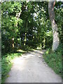
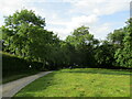
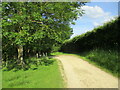
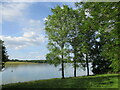
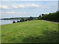
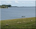
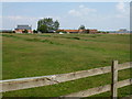
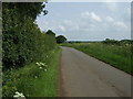
Rutland stands as the smallest historic county in England, spanning just 394.0 km². This ceremonial county and unitary authority resides in the East Midlands, centred near Oakham at coordinates 52.660752077663005, -0.6546495899064371. The area borders Leicestershire to the north and west, Lincolnshire to the north-east, and Northamptonshire and Cambridgeshire to the south-west. Despite its compact size, the county holds ancient significance, having re-established unitary and ceremonial status on 1 April 1997. Its motto, "Multum in parvo," translates to "Much in little," reflecting a character defined by golden ironstone villages and farmland vistas. You will live in a predominantly rural setting featuring ancient churches, market towns like Oakham and Uppingham, and sites such as Rutland Water and Oakham Castle. The local atmosphere remains tranquil, celebrated for its charisma rather than rapid urban development. Your daily life revolves around a landscape of fields and historic buildings rather than city congestion. This distinct environment appeals to those seeking quiet living within a recognised administrative boundary. The county offers a unique scale where proximity to neighbouring regions allows easy travel without sacrificing the seclusion of village living.
- Area Type
- Ceremonial Counties Region
- Area Size
- 394.0 km²
- Population
- Not available
- Population Density
- Not available
Demographics
The community within Rutland reflects a settlement established by older residents. The median age for the population reaches 70 years, indicating a demographic profile skewed significantly towards the elderly. Most common age categories align with this total, suggesting limited young family presence compared to other English counties. You will find an established neighbourhood where life expectancy lengthens and lifestyle priorities shift towards retirement rather than career building. Home ownership sits at an impressive 72% of households, meaning the vast majority of residents own their properties outright or with a mortgage. This high level of ownership contrasts sharply with younger urban areas where renting remains common. The predominant settlement types remain rural villages and market towns rather than high-density housing blocks. While specific ethnicity and religion statistics are absent from current records, the social fabric appears stable under a shared commitment to property ownership. This demographic structure implies a slower pace of life and different community needs. You are entering an area where inherited homes and long-term residency define the social network. The absence of large temporary populations suggests minimal disruption to local traditions. Residents benefit from a stable tax base and low transient pressure on council services. Your neighbours likely value their positions just as much as you do.