Area Overview for Ruskington
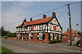
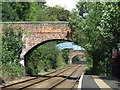
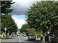
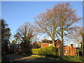
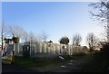
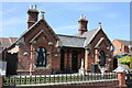
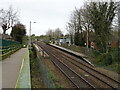
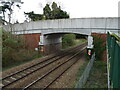
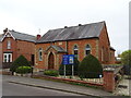
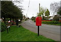
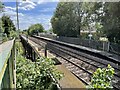
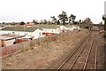
Photos of Ruskington
Area Information
Ruskington is a compact built-up area in England, covering just 1.8 km², yet it offers a blend of practicality and accessibility for residents. With a median age of 70, the community is predominantly mature, suggesting a population skewed towards retirees or long-term residents. The area’s home ownership rate of 74% indicates a stable, owner-occupied demographic, which often correlates with established neighbourhoods. Daily life in Ruskington is shaped by its proximity to key infrastructure: four nearby rail stations, including Ruskington and Sleaford, provide reliable transport links, while RAF Cranwell offers a unique local landmark. The area’s broadband score of 92 — excellent — ensures seamless digital connectivity, ideal for those working remotely or relying on online services. Schools such as Ruskington Chestnut Street Church of England Academy, rated good by Ofsted, and Coteland’s School, add to the appeal for families. While Ruskington lacks sprawling green spaces, its compact size and strategic location make it a pragmatic choice for those prioritising convenience, safety, and ease of access to regional hubs.
- Area Type
- Built Up Area 250
- Area Size
- 1.8 km²
- Population
- Not available
- Population Density
- Not available
Residents of Ruskington have access to a range of local amenities within practical reach. Five retail outlets, including Spar and Lincolnshire Co-operative Co, provide essential shopping options for daily needs. The area’s rail stations — Ruskington, Sleaford, and Rauceby — offer direct links to nearby towns, enhancing mobility for commuting or leisure. The presence of RAF Cranwell adds a distinctive local feature, though its civilian accessibility is limited. While the data does not mention parks or leisure facilities, the compact size of Ruskington suggests that residents may rely on nearby towns for recreational activities. The combination of retail convenience, rail connectivity, and digital infrastructure supports a lifestyle that balances practicality with ease of access. For those who prefer a quiet, self-contained environment, Ruskington’s amenities are sufficient for everyday living, with the added benefit of proximity to regional hubs.
Amenities
Schools
Ruskington offers a range of primary schools, including Winchelsea Primary School Ruskington, Coteland’s School Ruskington, and Ruskington Chestnut Street CofE Primary School. Two of these, Ruskington Chestnut Street Church of England Academy and Winchelsea Primary School, are rated good by Ofsted, indicating a solid educational foundation. The presence of both traditional primary schools and an academy provides families with choices in curriculum and teaching approaches. The good Ofsted ratings suggest that these schools meet or exceed national standards, which is a key consideration for parents prioritising quality education. However, the data does not mention secondary schools or further education options, so families requiring comprehensive schooling may need to look beyond Ruskington. For those focused on primary education, the area’s schools offer a mix of established institutions and academies, ensuring a range of opportunities for children.
| Rank | School | Type | Entry gender | Ages |
|---|
Explore more schools in this area
Go to Schools tabDemographics
Ruskington’s population is defined by its median age of 70, reflecting a community that is predominantly older. This suggests a demographic where retirees or long-term residents form the majority, which can influence local services and social dynamics. The home ownership rate of 74% indicates that most residents live in properties they own, contributing to a sense of stability. However, the data does not specify household composition or diversity, so it is unclear whether the area includes a mix of single-person households, couples, or families. The absence of detailed information on accommodation types or ethnic composition means the community’s diversity cannot be assessed. That said, the low crime risk — a pass with a safety score of 84 — implies a secure environment, which is particularly relevant for older residents. The area’s character is shaped by its mature population and owner-occupied homes, creating a distinct rhythm of daily life that differs from younger, more transient communities.