Area Overview for Rushton
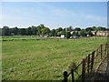
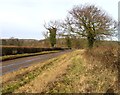
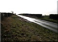
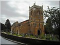
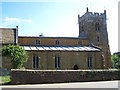
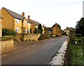
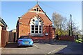
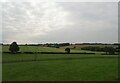
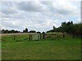
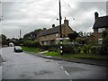
Photos of Rushton


Area Information
Rushton is a compact built-up area in England, covering 22 hectares and serving as a practical, low-key community. With a median age of 70, the area is predominantly home to older residents, suggesting a settled, long-term population. Daily life here is likely shaped by proximity to local amenities, including retail outlets like Co-op Rothwell and Asda Kettering, which are within practical reach. The area is well-connected via transport, with access to Kettering and Corby railway stations, as well as a bus interchange, offering flexibility for commuters. Homeownership is strong, at 68%, indicating a stable housing market. Families with children may find Rushton Primary School, rated 'good' by Ofsted, a key draw. While the area lacks sprawling parks or cultural hubs, its straightforward layout and accessible services cater to those prioritising convenience over novelty. For buyers seeking a quiet, established community with reliable infrastructure, Rushton offers a straightforward, no-frills lifestyle.
- Area Type
- Built Up Area 250
- Area Size
- 22.0 hectares
- Population
- Not available
- Population Density
- Not available
Rushton’s lifestyle is shaped by its accessible amenities, including retail outlets like Co-op Rothwell, Asda Kettering, and Tesco Rothwell, which provide everyday shopping needs. The bus interchange and two railway stations—Kettering and Corby—offer convenient transport options, connecting residents to nearby services and employment hubs. While the area lacks detailed information on parks or leisure facilities, its compact size and proximity to retail and transport suggest a practical, no-frills lifestyle. The presence of a primary school with a 'good' Ofsted rating adds to the appeal for families, though secondary education options are not specified. Overall, Rushton caters to those who value convenience and reliability over expansive recreational spaces, with daily life revolving around local shops, transport, and community institutions.
Amenities
Schools
Rushton Primary School is the only educational institution explicitly listed in the data, serving the area’s primary education needs. The school is noted as a primary school with an Ofsted rating of 'good', which indicates it meets standard educational benchmarks. As the sole school mentioned, it is the primary option for families in the area, though no secondary schools or other educational facilities are referenced. The absence of additional schools suggests that students may need to travel to nearby towns for secondary education, which could be a consideration for families. The 'good' rating implies the school provides a reliable foundation for young learners, though the lack of detailed performance metrics or parental feedback means further research would be necessary for a full evaluation.
| Rank | A + A* % | School | Type | Entry gender | Ages |
|---|---|---|---|---|---|
| 1 | N/A | Rushton Primary School | primary | N/A | N/A |
| 2 | N/A | Rushton Primary School | primary | N/A | N/A |
Explore more schools in this area
Go to Schools tabDemographics
Rushton’s population is defined by its median age of 70, the highest in the dataset, suggesting a community dominated by older adults. The most common age range is listed as 'Age: Total', which may reflect aggregated data rather than a specific demographic. Homeownership stands at 68%, a figure that indicates a majority of residents live in properties they own, though the data does not specify whether this includes rented homes or private ownership. Household composition and accommodation types are not detailed, but the area’s built-up nature implies a mix of housing stock. Ethnicity and religion are also reported as 'Total', offering no breakdown of diversity. This lack of granularity means the community’s cultural or religious makeup remains unclear. The absence of deprivation data means quality of life factors like access to services or economic hardship are not quantified, though proximity to retail and transport suggests basic needs are met.
Household Size
Accommodation Type
Tenure
Ethnic Group
Religion
Household Composition
Age
Household Deprivation
NS-SEC
Explore more demographic insights in this area
Go to Demographics tabPlanning
Planning Constraints
- Crime RiskLocked