Area Overview for Rothwell and Mawsley Ward
Photos of Rothwell and Mawsley Ward
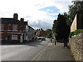
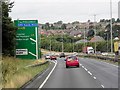
![Fox Street, Rothwell [B576] in Rothwell and Mawsley Ward](https://images.propbar.co.uk/images/geograph/18/34/1834560_120.jpg)
Area Information
Living in Rothwell and Mawsley Ward offers a distinct residential experience within a defined geographical boundary covering 68.0 km² in England. This district borough unitary ward is characterised by a very low population density, with just 40 people per square kilometre. You will find a community of approximately 2,750 individuals spread across this extensive landscape, creating a quiet and spacious environment. Daily life here is defined by significant room and limited immediate crowds, which stands in contrast to more densely populated urban zones. The area provides a stable setting for those seeking seclusion without venturing far from established infrastructure. Prospective buyers considering Rothwell and Mawsley Ward should expect a locality where property sits well apart from neighbours. The physical size of the ward allows for a variety of housing settings while maintaining a consistent village-like atmosphere. When planning your move, you are entering an area where the ratio of green space and roads to residents is high. This structure supports a peaceful routine for anyone prioritising tranquility. Understanding the scale of 68.0 km² helps contextualise the distance to nearby amenities and the overall isolation factor of your potential new home. The community in Rothwell and Mawsley Ward is defined by a mature population profile, with a median age of 70 years. This figure indicates that households here are predominantly occupied by older adults rather than young families or commuters. The total age range data confirms a consistent demographic structure without significant shifts toward younger generations. Home ownership stands at 71 per cent, meaning that almost four out of five residents own their homes outright or with a mortgage. This high ownership rate suggests a stable, settled community with long-term residents. The data does not provide specific details regarding ethnic groups, religious affiliations, or specific household compositions such as single-person or multi-generational living. However, the aggregate figures point to an area that is economically stable and demographically homogenous in its tenure status. You can evaluate quality of life by noting that a large majority of residents have a vested interest in the local environment through property ownership. The absence of data on household composition means you should assume traditional family or elderly couple arrangements dominate based on the age statistics. When assessing suitability, consider whether a community with a median age of 70 aligns with your lifestyle needs. The property market in Rothwell and Mawsley Ward is heavily tipped toward owner-occupation, with home ownership standing at 71 per cent. This statistic reveals a housing stock where the vast majority of properties are privately held rather than part of the private rental sector. Buyers looking at Rothwell and Mawsley Ward should encounter an environment where existing owners tend to reside in their properties for extended periods. The high ownership percentage often correlates with a diverse range of accommodation types, from detached houses to bungalows, catering to an older demographic. Although specific data on the breakdown of detached, semi-detached, or terraced homes is not provided, the tenure figure implies reduced availability for private renters compared to younger, commuter-heavy areas. Families considering homes in Rothwell and Mawsley Ward may find the purchase market more active than the rental market. The local estate is likely built upon a foundation of stock acquired many years ago, reflecting the area's historical development patterns. You will likely face competition primarily from other existing owners looking to upgrade rather than from first-time buyers struggling to secure entry-level rentals. This market dynamic creates a specific set of opportunities for investors or individuals ready to invest in a brick-and-mortar asset within this ward. Digital connectivity in Rothwell and Mawsley Ward is exceptionally strong, making the area highly suitable for remote working and heavy internet use. The fixed broadband quality score reaches 94 out of 100, placing this ward among the top performers for digital infrastructure in the country. Such a high rating ensures reliable high-speed connections regardless of your specific location within the 68.0 km² land area. You can access the internet with minimal interruption, which is critical for professionals working from home or those streaming entertainment in a large household. Mobile data performance also supports this excellent score, providing comprehensive coverage across the ward. For residents, this level of connectivity removes the common rural isolation factor often associated with living in sparsely populated areas like this one. You will not face the frustration of buffering videos or experiencing slow upload speeds that plague other regions with lower connectivity scores. The robust digital network integrates seamlessly with the wider transport framework, allowing residents to stay connected while enjoying the quiet of the neighbourhood. Whether you require high-bandwidth gaming, video conferencing, or large file transfers, the infrastructure in Rothwell and Mawsley Ward consistently meets demanding user requirements without compromise. Safety and environmental factors in Rothwell and Mawsley Ward present a largely reassuring picture for potential residents, though one minor planning constraint exists. The crime risk assessment passes with a score of 71, indicating low crime risk relative to national averages. Residents can expect below-average crime rates, contributing to a safer neighbourhood atmosphere. Flood risk is similarly low, with a score of 2.73, meaning the area has low flood risk coverage and is not prone to water-related hazards. You will find no Ramsar wetland sites, areas of outstanding natural beauty, or protected nature reserves within the ward boundaries, which simplifies certain planning considerations. However, there is a warning level designation for protected woodland, with a score of 1.4, indicating the area contains protected woodland coverage. This constraint may impact future development proposals within those specific green spaces. Overall, the ward passes most critical safety and environmental assessments, offering a stable setting for living. The low flood risk and low crime statistics form the backbone of the area's safety profile, allowing you to focus on local amenities and community integration. You can approach daily life here with confidence that major environmental threats and criminal activity are well below the levels found in many other parts of the UK. Who typically lives in Rothwell and Mawsley Ward?The community in Rothwell and Mawsley Ward has a median age of 70, signifying it is an area populated by older residents rather than young families. With a home ownership rate of 71 per cent, the ward consists largely of settled homeowners. The total population of 2,750 people spread across the area suggests a mature, stable demographic rather than a transient commuter population. Specifically, the data points to an older community structure dominating the local housing market. Is the internet connection reliable in Rothwell and Mawsley Ward?The fixed broadband quality score for Rothwell and Mawsley Ward is 94 out of 100, indicating excellent digital connectivity. This high score ensures that residents can work from home or stream content without significant issues. The robust network infrastructure covers the entire ward, making it a reliable choice for anyone dependent on high-speed internet for their daily activities or professional work. What is the crime and flood risk like?Safety in Rothwell and Mawsley Ward is high, with a crime risk score of 71 marking it as a safer neighbourhood with below-average crime rates. Additionally, the flood risk score is 2.73, indicating low flood risk coverage. These assessments confirm that the ward offers a secure living environment free from significant environmental threats or high crime levels.
- Area Type
- District Borough Unitary Ward
- Area Size
- 68.0 km²
- Population
- 2750
- Population Density
- 40 people/km²
Demographics
The community in Rothwell and Mawsley Ward is defined by a mature population profile, with a median age of 70 years. This figure indicates that households here are predominantly occupied by older adults rather than young families or commuters. The total age range data confirms a consistent demographic structure without significant shifts toward younger generations. Home ownership stands at 71 per cent, meaning that almost four out of five residents own their homes outright or with a mortgage. This high ownership rate suggests a stable, settled community with long-term residents. The data does not provide specific details regarding ethnic groups, religious affiliations, or specific household compositions such as single-person or multi-generational living. However, the aggregate figures point to an area that is economically stable and demographically homogenous in its tenure status. You can evaluate quality of life by noting that a large majority of residents have a vested interest in the local environment through property ownership. The absence of data on household composition means you should assume traditional family or elderly couple arrangements dominate based on the age statistics. When assessing suitability, consider whether a community with a median age of 70 aligns with your lifestyle needs. The property market in Rothwell and Mawsley Ward is heavily tipped toward owner-occupation, with home ownership standing at 71 per cent. This statistic reveals a housing stock where the vast majority of properties are privately held rather than part of the private rental sector. Buyers looking at Rothwell and Mawsley Ward should encounter an environment where existing owners tend to reside in their properties for extended periods. The high ownership percentage often correlates with a diverse range of accommodation types, from detached houses to bungalows, catering to an older demographic. Although specific data on the breakdown of detached, semi-detached, or terraced homes is not provided, the tenure figure implies reduced availability for private renters compared to younger, commuter-heavy areas. Families considering homes in Rothwell and Mawsley Ward may find the purchase market more active than the rental market. The local estate is likely built upon a foundation of stock acquired many years ago, reflecting the area's historical development patterns. You will likely face competition primarily from other existing owners looking to upgrade rather than from first-time buyers struggling to secure entry-level rentals. This market dynamic creates a specific set of opportunities for investors or individuals ready to invest in a brick-and-mortar asset within this ward. Digital connectivity in Rothwell and Mawsley Ward is exceptionally strong, making the area highly suitable for remote working and heavy internet use. The fixed broadband quality score reaches 94 out of 100, placing this ward among the top performers for digital infrastructure in the country. Such a high rating ensures reliable high-speed connections regardless of your specific location within the 68.0 km² land area. You can access the internet with minimal interruption, which is critical for professionals working from home or those streaming entertainment in a large household. Mobile data performance also supports this excellent score, providing comprehensive coverage across the ward. For residents, this level of connectivity removes the common rural isolation factor often associated with living in sparsely populated areas like this one. You will not face the frustration of buffering videos or experiencing slow upload speeds that plague other regions with lower connectivity scores. The robust digital network integrates seamlessly with the wider transport framework, allowing residents to stay connected while enjoying the quiet of the neighbourhood. Whether you require high-bandwidth gaming, video conferencing, or large file transfers, the infrastructure in Rothwell and Mawsley Ward consistently meets demanding user requirements without compromise. Safety and environmental factors in Rothwell and Mawsley Ward present a largely reassuring picture for potential residents, though one minor planning constraint exists. The crime risk assessment passes with a score of 71, indicating low crime risk relative to national averages. Residents can expect below-average crime rates, contributing to a safer neighbourhood atmosphere. Flood risk is similarly low, with a score of 2.73, meaning the area has low flood risk coverage and is not prone to water-related hazards. You will find no Ramsar wetland sites, areas of outstanding natural beauty, or protected nature reserves within the ward boundaries, which simplifies certain planning considerations. However, there is a warning level designation for protected woodland, with a score of 1.4, indicating the area contains protected woodland coverage. This constraint may impact future development proposals within those specific green spaces. Overall, the ward passes most critical safety and environmental assessments, offering a stable setting for living. The low flood risk and low crime statistics form the backbone of the area's safety profile, allowing you to focus on local amenities and community integration. You can approach daily life here with confidence that major environmental threats and criminal activity are well below the levels found in many other parts of the UK. Who typically lives in Rothwell and Mawsley Ward?The community in Rothwell and Mawsley Ward has a median age of 70, signifying it is an area populated by older residents rather than young families. With a home ownership rate of 71 per cent, the ward consists largely of settled homeowners. The total population of 2,750 people spread across the area suggests a mature, stable demographic rather than a transient commuter population. Specifically, the data points to an older community structure dominating the local housing market. Is the internet connection reliable in Rothwell and Mawsley Ward?The fixed broadband quality score for Rothwell and Mawsley Ward is 94 out of 100, indicating excellent digital connectivity. This high score ensures that residents can work from home or stream content without significant issues. The robust network infrastructure covers the entire ward, making it a reliable choice for anyone dependent on high-speed internet for their daily activities or professional work. What is the crime and flood risk like?Safety in Rothwell and Mawsley Ward is high, with a crime risk score of 71 marking it as a safer neighbourhood with below-average crime rates. Additionally, the flood risk score is 2.73, indicating low flood risk coverage. These assessments confirm that the ward offers a secure living environment free from significant environmental threats or high crime levels.
Household Size
Accommodation Type
Tenure
Ethnic Group
Religion
Household Composition
Age
Household Deprivation
NS-SEC
Explore more demographic insights in this area
Go to Demographics tabPlanning
Planning Constraints
- Flood RiskPremium
- Ramsar Wetland SitesPremium
- Area of Outstanding Natural BeautyPremium
- Protected Nature ReservePremium
- Protected WoodlandPremium
- Crime RiskPremium