Area Overview for Rothley
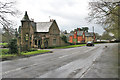
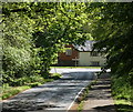
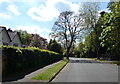
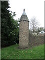
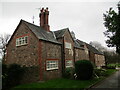
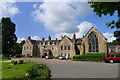
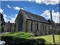
Photos of Rothley


Area Information
Rothley is a compact built-up area in England, covering 67.8 hectares and home to a population with a median age of 70. This suggests a community skewed toward older residents, which may influence the local character and pace of life. The area is well-connected, with five nearby railway stations, including Sileby, Barrow upon Soar, and Syston, offering regular commuter links. Retail options are varied, with Co-op stores in Mountsorrel and Rothley, as well as a Waitrose in Little, ensuring daily essentials are within reach. Rothley’s proximity to the Great Central Railway and historic sites like Quorn & Woodhouse adds a touch of heritage to everyday living. For those seeking a quieter lifestyle, the area’s modest size and established infrastructure make it a practical choice, though it may lack the vibrancy of larger urban centres. The combination of accessible transport, familiar retail chains, and a mature demographic creates a distinct identity that caters to those prioritising convenience over novelty.
- Area Type
- Built Up Area 250
- Area Size
- 67.8 hectares
- Population
- Not available
- Population Density
- Not available
Rothley’s residents have access to a range of amenities within practical reach. The area includes five retail locations, such as Co-op Mountsorrel, Co-op Rothley, and Waitrose Little, ensuring grocery and daily shopping needs are met. Nearby railway stations, including Sileby and Barrow upon Soar, provide regular commuter links, while the Great Central Railway adds a touch of historical interest for leisure trips. The proximity to Quorn & Woodhouse and other metro points suggests a blend of practical and recreational transport options. For those seeking a mix of convenience and heritage, Rothley’s amenities offer a straightforward, functional lifestyle. The presence of multiple retail and transport hubs means daily errands and travel are efficiently managed, though the area’s character remains rooted in its quieter, established appeal.
Amenities
Schools
| Rank | A + A* % | School | Type | Entry gender | Ages |
|---|
Explore more schools in this area
Go to Schools tabDemographics
Rothley’s population has a median age of 70, indicating a community predominantly composed of older individuals. This age profile suggests a stable, low-turnover demographic, which may influence local services and amenities. Home ownership is high, with 84% of residents owning their homes, reflecting a long-term commitment to the area. However, data on household composition, accommodation types, and ethnic diversity is not available, meaning further details about the community’s structure or cultural mix cannot be provided. The absence of specific figures on deprivation or socioeconomic status means quality-of-life implications beyond home ownership and age remain unexplored. For those considering Rothley, the high home ownership rate and older population may signal a mature, settled environment, though it is advisable to seek additional local insights for a fuller picture.
Household Size
Accommodation Type
Tenure
Ethnic Group
Religion
Household Composition
Age
Household Deprivation
NS-SEC
Explore more demographic insights in this area
Go to Demographics tabPlanning
Planning Constraints
- Crime RiskLocked