Area Overview for Rothersthorpe
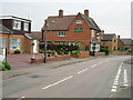
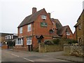
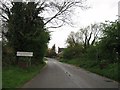
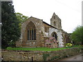
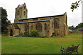
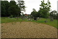
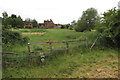
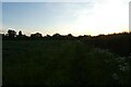
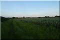
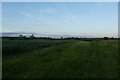
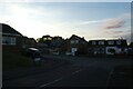
Photos of Rothersthorpe
Area Information
Rothersthorpe is a compact built-up area in England, spanning 21.1 hectares. It is a town with a distinct character shaped by its older population, with a median age of 70, suggesting a community rooted in stability and long-term residency. The area is well-served by essential services, including retail outlets, transport links, and educational institutions. For those considering living in Rothersthorpe, the high home ownership rate of 80% indicates a predominantly owner-occupied environment, which may appeal to buyers seeking a settled, community-focused lifestyle. Proximity to Northampton Railway Station and nearby bus interchanges ensures connectivity to the wider region, while local shops like Tesco Northampton and Co-op Pineham provide daily convenience. The area’s safety profile, with a crime risk score of 78, further enhances its appeal as a low-risk, family-friendly neighbourhood. Rothersthorpe offers a blend of practicality and tranquillity, ideal for those prioritising security, accessibility, and a slower pace of life.
- Area Type
- Built Up Area 250
- Area Size
- 21.1 hectares
- Population
- Not available
- Population Density
- Not available
Rothersthorpe’s lifestyle is shaped by its proximity to essential amenities. Local shops like Spar, Co-op Pineham, and Tesco Northampton provide everyday convenience, while the Northampton Railway Station and nearby bus interchanges facilitate travel to the city and beyond. The area’s retail options cater to both routine needs and occasional shopping trips. For leisure, the presence of transport hubs and nearby educational institutions suggests opportunities for socialising and community engagement. While specific parks or recreational areas are not mentioned in the data, the practical reach of amenities implies a functional, service-oriented lifestyle. The combination of retail, transport, and connectivity ensures residents can access what they need without long commutes, supporting a balanced daily routine.
Amenities
Schools
Rothersthorpe Church of England Primary School is the only school explicitly listed in the data, serving the local primary education needs. As a primary school, it caters to younger children, though the absence of secondary schools or other educational institutions in the data means families may need to look beyond the immediate area for comprehensive schooling. The single listed school suggests a focus on early education, which could be a consideration for families with young children. However, the lack of additional schools in the data means the full range of educational options available to residents remains unclear.
| Rank | A + A* % | School | Type | Entry gender | Ages |
|---|---|---|---|---|---|
| 1 | N/A | Rothersthorpe Church of England Primary School | primary | N/A | N/A |
| 2 | N/A | Rothersthorpe Church of England Primary School | primary | N/A | N/A |
Explore more schools in this area
Go to Schools tabDemographics
Rothersthorpe’s population is predominantly older, with a median age of 70, reflecting a community where many residents have lived for decades. This demographic profile suggests a stable, low-turnover environment. Home ownership is high, with 80% of households owning their homes, which may contribute to a sense of permanence and shared local identity. The data does not specify household composition, accommodation types, or ethnic diversity, but the high home ownership rate implies a mature population with long-term ties to the area. The absence of detailed diversity metrics means the community’s cultural and social makeup remains less defined in the data. For buyers, this suggests a neighbourhood with a strong sense of continuity, though it may also indicate limited generational turnover.
Household Size
Accommodation Type
Tenure
Ethnic Group
Religion
Household Composition
Age
Household Deprivation
NS-SEC
Explore more demographic insights in this area
Go to Demographics tabPlanning
Planning Constraints
- Crime RiskLocked