Area Overview for Ropsley
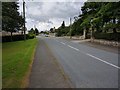
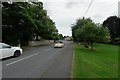
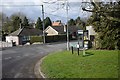
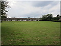
Photos of Ropsley


Area Information
Ropsley is a compact built-up area in England, spanning 33.3 hectares. Its population, while not explicitly quantified, reflects a community with a median age of 70, suggesting a mature demographic. Daily life here is shaped by proximity to essential services, including a primary school with a good Ofsted rating and nearby retail outlets. The area’s accessibility to Grantham Railway Station and RAF Barkston Heath airport underscores its strategic location. While Ropsley may not be a bustling urban hub, its quiet character and practical amenities cater to those seeking a stable, low-maintenance lifestyle. The presence of 5 retail stores, including Tesco Grantham and Morrisons, ensures everyday needs are met without long commutes. For buyers, Ropsley offers a blend of simplicity and convenience, ideal for those prioritising safety, community cohesion, and proximity to transport links.
- Area Type
- Built Up Area 250
- Area Size
- 33.3 hectares
- Population
- Not available
- Population Density
- Not available
Residents of Ropsley have access to 5 retail stores, including Tesco Grantham and Morrisons, providing convenience for shopping and daily essentials. The area’s proximity to Grantham Railway Station and RAF Barkston Heath airport enhances mobility, allowing easy travel to nearby towns or for business purposes. While parks or leisure facilities are not specified in the data, the presence of multiple retail outlets and transport links suggests a lifestyle focused on practicality and connectivity. The mix of shops and transport options supports a routine that prioritises ease of access over extensive recreational amenities.
Amenities
Schools
The Ropsley Church of England Primary School is the only school explicitly listed in the data, serving the area’s younger residents. Rated ‘good’ by Ofsted, it provides a solid foundation for primary education. While no secondary schools are mentioned, the presence of a primary school with a strong rating is a key consideration for families. The absence of additional schools suggests that families may need to travel to nearby towns for secondary education, though the proximity to Grantham Railway Station could ease such commutes. For those prioritising quality primary education, Ropsley’s school offers a reliable option.
| Rank | A + A* % | School | Type | Entry gender | Ages |
|---|---|---|---|---|---|
| 1 | N/A | The Ropsley Church of England Primary School | primary | N/A | N/A |
Explore more schools in this area
Go to Schools tabDemographics
Ropsley’s population is predominantly older, with a median age of 70, indicating a community where retirees and long-term residents form the majority. Home ownership is high at 78%, reflecting a stable housing market where most properties are owner-occupied rather than rented. The data does not specify household composition or ethnic diversity, but the figures suggest a relatively homogenous population. The absence of detailed demographic breakdowns means broader conclusions about cultural or generational diversity are not supported by the available data. For those considering Ropsley, the age profile and ownership rates imply a quiet, settled environment with fewer transient residents.
Household Size
Accommodation Type
Tenure
Ethnic Group
Religion
Household Composition
Age
Household Deprivation
NS-SEC
Explore more demographic insights in this area
Go to Demographics tabPlanning
Planning Constraints
- Crime RiskLocked