Area Overview for Risley
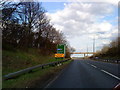
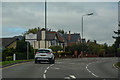
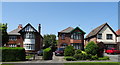
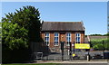
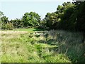
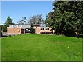
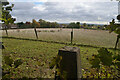
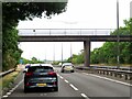
Photos of Risley


Area Information
Risley is a compact built-up area spanning 46.3 hectares, nestled in England. Its population, while not specified in exact numbers, is defined by a median age of 70, suggesting a community skewed toward older residents. Daily life here is shaped by proximity to essential services, with nearby schools, transport links, and retail options within practical reach. The area’s safety profile is reassuring, with a crime risk score of 77, indicating below-average crime rates. For those considering living in Risley, the blend of accessible amenities and a stable, mature demographic makes it a practical choice. The presence of multiple retail outlets, including Co-op and Lidl, and the ease of rail travel to nearby stations like Long Eaton and Attenborough underscore the area’s connectivity. With broadband quality rated at 88 and mobile coverage at 85, residents benefit from reliable digital infrastructure, supporting both work and leisure. Risley’s character is defined by its quiet, established feel, where convenience meets a sense of security.
- Area Type
- Built Up Area 250
- Area Size
- 46.3 hectares
- Population
- Not available
- Population Density
- Not available
Residents of Risley have access to a variety of amenities within practical reach, enhancing daily life. The area is served by five retail outlets, including Co-op Sandiacre, Lidl Sandiacre, and Co-op Grasmere, offering essential shopping options. Public transport is well-integrated, with tram stops at Tram Park & Ride and Toton Lane, and rail stations at Long Eaton, Attenborough, and Spondon, connecting residents to wider networks. The proximity to East Midlands Airport adds to the area’s convenience for travel. While the data does not specify parks or leisure facilities, the presence of multiple retail and transport options suggests a practical, service-oriented lifestyle. For those prioritising accessibility and ease of movement, Risley’s amenities provide a functional backdrop to everyday living.
Amenities
Schools
The nearest school to Risley is Risley Lower Grammar CE (VC) Primary School, which serves the local community with a primary education offering. The school holds an Ofsted rating of “good,” indicating a satisfactory standard of teaching and facilities. While the data does not list secondary schools or other educational institutions, the presence of this primary school suggests that families with young children may find the area suitable for their needs. The single school listed highlights the importance of this institution to the local community, though the absence of additional schools means families may need to consider nearby options for secondary education. For those prioritising proximity to schools, Risley’s primary offering provides a reliable foundation for early years education.
| Rank | School | Type | Entry gender | Ages |
|---|
Explore more schools in this area
Go to Schools tabDemographics
Risley’s demographic profile is marked by a median age of 70, reflecting a population that is predominantly older. The most common age range is listed as “Age: Total,” though specific breakdowns of household composition or accommodation types are not detailed. Home ownership in the area is high, with 82% of residents owning their homes, suggesting a stable, long-term community. The data does not specify ethnic or religious diversity, but the overall composition appears to align with broader regional trends. The absence of detailed deprivation metrics means the area’s quality of life cannot be assessed in terms of economic hardship, though the high home ownership rate implies financial stability for many residents. For those considering Risley, the demographic makeup suggests a mature, settled population with established roots in the community.
Household Size
Accommodation Type
Tenure
Ethnic Group
Religion
Household Composition
Age
Household Deprivation
NS-SEC
Explore more demographic insights in this area
Go to Demographics tabPlanning
Planning Constraints
- Crime RiskPremium