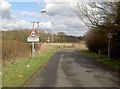
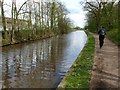
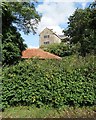
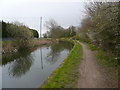
Area Overview for Rhodesia
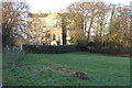
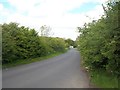
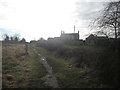
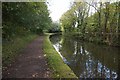
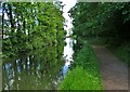
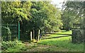
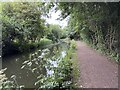
Photos of Rhodesia
Area Information
Rhodesia is a built-up area in England, covering 24.8 hectares. It sits within a larger town or city, though its precise administrative boundaries are not specified. The area’s demographic profile is notable: the median age of residents is 70, indicating a community skewed toward older adults. This suggests a quieter, more settled environment, where many residents may have lived for decades. Home ownership in the area stands at 68%, reflecting a mix of long-term residents and property buyers. Daily life here is likely characterised by a slower pace, with local amenities and transport links playing a central role. The proximity to Worksop and its surrounding infrastructure—such as railway stations and major retailers—offers practical convenience. For those considering living in Rhodesia, the area’s compact size and established character may appeal to those seeking stability and accessibility over rapid change.
- Area Type
- Built Up Area 250
- Area Size
- 24.8 hectares
- Population
- Not available
- Population Density
- Not available
Residents of Rhodesia have access to a selection of retail and transport amenities within practical reach. The area is within walking or short driving distance of major supermarkets such as Sainsburys, Asda, and Tesco in Worksop, offering convenience for daily shopping. Five railway stations—Shireoaks, Worksop, and Whitwell—provide easy access to regional transport networks, enhancing connectivity to nearby towns and cities. While the data does not mention parks or leisure facilities, the presence of retail and rail options suggests a practical lifestyle focused on accessibility. The combination of local shopping and transport links makes Rhodesia a viable choice for those prioritising convenience over expansive recreational spaces.
Amenities
Schools
The nearest school to Rhodesia is Haggonfields Primary and Nursery School, which serves the area’s younger residents. This primary school has been rated as ‘good’ by Ofsted, indicating a satisfactory standard of education. As the only named school in the data, it is the primary option for families in the area. The absence of secondary schools or additional educational institutions nearby suggests that students may need to travel to nearby towns for secondary education. For families prioritising a strong primary school, Haggonfields offers a reliable option, though the single school type may limit choices for those seeking a broader range of educational settings.
| Rank | A + A* % | School | Type | Entry gender | Ages |
|---|---|---|---|---|---|
| 1 | N/A | Haggonfields Primary and Nursery School | primary | N/A | N/A |
| 2 | N/A | Haggonfields Primary and Nursery School | primary | N/A | N/A |
Explore more schools in this area
Go to Schools tabDemographics
Rhodesia’s population is predominantly composed of residents aged 70, with no specific age group dominating beyond this median figure. The home ownership rate of 68% suggests a significant portion of the community consists of long-term residents who have owned their properties for years. This figure also implies that 32% of homes are rented, though the exact proportion of renters versus owner-occupiers is not detailed. The data does not specify household composition, accommodation types, or ethnic diversity, but the high median age may indicate a community with fewer young families and more retired individuals. This demographic profile could influence local services and amenities, with a focus on healthcare and leisure suited to older adults.
Household Size
Accommodation Type
Tenure
Ethnic Group
Religion
Household Composition
Age
Household Deprivation
NS-SEC
Explore more demographic insights in this area
Go to Demographics tabPlanning
Planning Constraints
- Crime RiskLocked