Area Overview for Renishaw
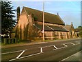
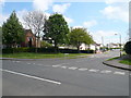
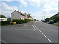
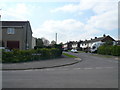
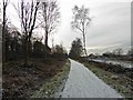
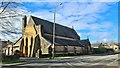
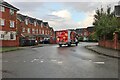
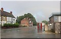
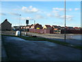
Photos of Renishaw


Area Information
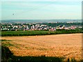
Renishaw is a compact built-up area spanning 57.2 hectares, offering a blend of residential and community spaces. With a median age of 70, it reflects a community skewed toward older residents, suggesting a quieter, more established character. The area’s proximity to amenities like Co-op Renishaw, Aldi Eckington, and nearby railway stations at Kiveton Bridge and Woodhouse ensures practical access to daily essentials. For families, Renishaw Primary School provides a local education option, though its Ofsted rating is satisfactory, indicating room for improvement. The area’s transport network includes multiple metro platforms and bus routes, connecting residents to broader regional hubs. While the population data does not specify household types or diversity, the 69% home ownership rate suggests a stable, long-term resident base. Renishaw’s charm lies in its manageable size and accessibility, making it a viable choice for those seeking a low-maintenance, community-oriented lifestyle without the need for a car.
- Area Type
- Built Up Area 250
- Area Size
- 57.2 hectares
- Population
- Not available
- Population Density
- Not available
Residents of Renishaw have access to a range of amenities within practical reach, enhancing daily life. Local shops include Co-op Renishaw and Aldi Eckington, providing essential groceries and household items. The area’s transport links, such as Kiveton Bridge Railway Station and the Coach Station, connect residents to nearby towns and cities, facilitating shopping, dining, or leisure trips. While the data does not list parks or recreational spaces, the presence of multiple retail and transport hubs suggests a convenient, community-focused lifestyle. The mix of retail options and public transport makes Renishaw appealing to those who value accessibility and the ability to meet daily needs without a car. However, buyers should explore whether the area’s amenities align with their preferences for outdoor spaces or cultural attractions.
Amenities
Schools
The nearest school to Renishaw is Renishaw Primary School, which serves the local community with a primary education offering. Its Ofsted rating is ‘satisfactory,’ indicating that while the school meets basic standards, it may not excel in areas such as pupil outcomes or staff performance. Families considering Renishaw should note that no secondary schools are listed in the data, meaning students would need to commute to nearby towns for further education. The presence of a primary school is a key factor for families with young children, though the rating suggests that parents may need to supplement their child’s education with extracurricular activities or additional support. The school’s accessibility and quality are critical considerations for any buyer prioritising education in their decision-making.
| Rank | School | Type | Entry gender | Ages |
|---|
Explore more schools in this area
Go to Schools tabDemographics
Renishaw’s demographic profile is defined by its median age of 70, with the majority of residents falling into the ‘Age: Total’ category. This suggests a community where older adults form a significant proportion, potentially influencing local services and social dynamics. Home ownership is strong, with 69% of properties owned by residents, indicating a stable housing market. However, the data does not specify household composition or accommodation types, so it is unclear whether the area hosts a mix of single-person households, couples, or families. The ‘total’ designation for predominant ethnic group and religion means no breakdown of diversity is available. While this does not inherently indicate deprivation, the older demographic may have different needs, such as healthcare access or community support. Prospective buyers should consider whether the area’s characteristics align with their long-term living requirements.
Household Size
Accommodation Type
Tenure
Ethnic Group
Religion
Household Composition
Age
Household Deprivation
NS-SEC
Explore more demographic insights in this area
Go to Demographics tabPlanning
Planning Constraints
- Crime RiskPremium