Area Overview for Ratcliffe on Soar
Photos of Ratcliffe on Soar


Area Information
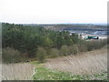
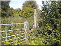
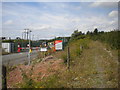
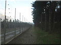
Ratcliffe on Soar is a compact built-up area covering 1.4 km², situated in a part of England where the rhythm of daily life is shaped by its proximity to transport hubs and local amenities. The area’s demographics suggest a community with a median age of 70, indicating a population skewed towards older residents. This is reflected in the high home ownership rate of 77%, suggesting a stable, long-term presence of residents. Living in Ratcliffe on Soar means being within reach of multiple rail stations, including East Midlands Parkway and Long Eaton, as well as tram stops like Clifton Park and Ride. The area’s connectivity extends to nearby airports, making it a practical choice for those needing regular travel. While the broadband score is modest, mobile coverage is strong, supporting both daily communication and remote work. The blend of local retail options, from Sainsburys to Co-op, and accessible public transport creates a functional environment for those prioritising convenience over urban vibrancy.
- Area Type
- Built Up Area 250
- Area Size
- 1.4 km²
- Population
- Not available
- Population Density
- Not available
Residents of Ratcliffe on Soar have access to a range of amenities within practical reach. Local retail options include Morrisons Daily, Sainsburys Long Eaton, and Co-op Draycott, providing everyday shopping convenience. The area’s transport network, with five metro and tram stops and four rail stations, ensures easy access to nearby towns and cities. For leisure, the proximity to Clifton Park and Ride and other tram stops suggests opportunities for outdoor activities and socialising. The two nearby East Midlands Airport locations further enhance the area’s appeal for those requiring frequent travel. While the data does not specify parks or cultural venues, the presence of multiple retail and transport hubs implies a lifestyle focused on practicality and connectivity. This makes Ratcliffe on Soar suitable for those prioritising accessibility over sprawling urban amenities.
Amenities
Schools
| Rank | School | Type | Entry gender | Ages |
|---|
Explore more schools in this area
Go to Schools tabDemographics
The population of Ratcliffe on Soar has a median age of 70, placing it among the oldest communities in the region. This age profile suggests a demographic where retirees and long-term residents form the majority. Home ownership stands at 77%, a figure that underscores the prevalence of owner-occupied properties and the stability of the housing market. The data does not specify household composition or ethnic diversity, but the high home ownership rate implies a community where property is often held long-term. The accommodation types are not detailed, but the overall picture points to a residential area with a focus on established homes rather than newer developments. The lack of specific data on deprivation or diversity means these aspects remain unexplored, but the existing figures highlight a mature, settled population with strong ties to their homes and local area.
Household Size
Accommodation Type
Tenure
Ethnic Group
Religion
Household Composition
Age
Household Deprivation
NS-SEC
Explore more demographic insights in this area
Go to Demographics tabPlanning
Planning Constraints
- Crime RiskPremium