Area Overview for Rand
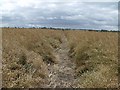
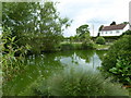
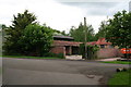
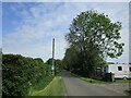
Photos of Rand


Area Information
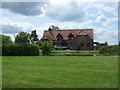
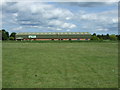
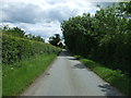
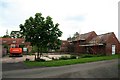
Rand stands as a distinct civil parish covering an area of 4.0 km², offering a specific type of lifestyle for those seeking a settled environment. Living in Rand provides a sense of enclosure typical of civil parishes, yet it maintains direct access to wider regional networks. The small geographic footprint allows residents to move quickly between home, local amenities, and natural spaces. This location is defined by stability and a lack of major industrial disruption. You will find a community where daily life centres on the immediate surroundings rather than commuting to distant zones for everything. The parish structure suggests a level of local governance focused on the specific needs of this compact demographic. Families and long-term residents often dominate the skyline here, contributing to a quiet rhythm of day-to-day existence. Homes in Rand are situated close enough to appreciate the surrounding geography while remaining practical for modern living. The area avoids the congestion of larger towns, yet it remains connected through digital infrastructure and regional roads. Whether you value a quick walk to nearby facilities or prefer the solitude of a smaller settlement, Rand delivers a functional and straightforward living experience.
- Area Type
- Parish
- Area Size
- 4.0 km²
- Population
- Not available
- Population Density
- Not available
Demographics
The community within Rand reflects a distinctly mature population profile. The median age here is 70, meaning more than half of the residents are over this age threshold. Most household composition statistics indicate a prevalence of older residents rather than young families or empty-nesters. This demographic reality shapes the character of the neighbourhood, creating an environment where established lifestyles prevail. Home ownership stands at an impressive 81%, suggesting that the vast majority of residents have bought into their properties rather than renting. This low rental rate points to a community where people put down roots and stay for the long term. Accommodation types in the parish generally align with permanent family homes suited for older owners rather than transient student or backpacker housing. The area does not show significant data on predominant ethnic groups or specific religious breakdowns, which often correlates with highly homogenous, traditional villages. While the most common age range currently lists as a total without a specific peak, the median figure confirms that health and leisure activities relevant to seniors drive local culture. This demographic skew means the local shops and social groups cater to an older clientele.
Household Size
Accommodation Type
Tenure
Ethnic Group
Religion
Household Composition
Age
Household Deprivation
NS-SEC
Explore more demographic insights in this area
Go to Demographics tabPlanning
Planning Constraints
- Flood RiskPremium
- Ramsar Wetland SitesPremium
- Area of Outstanding Natural BeautyPremium
- Protected Nature ReservePremium
- Protected WoodlandPremium
- Crime RiskPremium