Area Overview for Queniborough
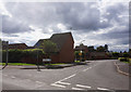
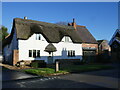
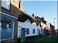
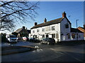
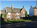
Photos of Queniborough


Area Information
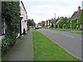
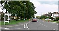
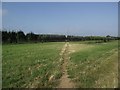
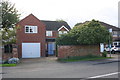
Queniborough is a compact built-up area in England, spanning 98.6 hectares. Its population, though not explicitly stated, is reflected in its demographics: the median age is 70, suggesting a community skewed toward older residents. This is a place where daily life is shaped by proximity to essential services and a relatively low crime risk. The area’s character is defined by its quiet, mature population and the presence of local amenities. Residents benefit from nearby rail connections, including Syston and Sileby stations, which link to broader networks. Queniborough Church of England Primary School, rated good by Ofsted, serves the community’s educational needs. The area’s appeal lies in its balance of practicality and safety, with 82% of homes owner-occupied, indicating a stable, long-term resident base. For those seeking a low-maintenance, secure environment with accessible transport and schools, Queniborough offers a distinct blend of simplicity and convenience.
- Area Type
- Built Up Area 250
- Area Size
- 98.6 hectares
- Population
- Not available
- Population Density
- Not available
Queniborough’s lifestyle is shaped by its proximity to retail and transport hubs. Nearby shops include M&S Branston BP, Morrisons Daily, and Iceland Leicester, offering convenience for grocery and retail needs. The area’s rail stations connect to Syston, Sileby, and Barrow upon Soar, while metro services like Great Central Railway and Rothley provide broader mobility. Although parks or leisure facilities are not specified, the presence of retail and transport options suggests a practical, service-oriented lifestyle. Residents can access daily essentials without long commutes, and the rail links support travel to nearby towns. The combination of retail convenience and transport connectivity makes Queniborough a functional choice for those prioritising accessibility over expansive leisure amenities.
Amenities
Schools
Queniborough Church of England Primary School is the only school explicitly mentioned in the data. It serves the area’s primary education needs and holds a good Ofsted rating, reflecting satisfactory standards in teaching and facilities. The absence of secondary schools or other educational institutions in the dataset means families may need to look beyond Queniborough for comprehensive schooling. However, the primary school’s good rating provides reassurance for those prioritising early education. For families, this suggests a focus on local primary education, with potential reliance on nearby towns for secondary schooling. The school’s presence adds to the area’s appeal for those valuing accessible, well-rated education for younger children.
| Rank | School | Type | Entry gender | Ages |
|---|
Explore more schools in this area
Go to Schools tabDemographics
Queniborough’s population has a median age of 70, the highest in the dataset, indicating a predominantly older community. This age profile shapes the area’s dynamics, with a focus on established residents rather than growing families. Home ownership is high at 82%, reflecting a strong presence of long-term property owners. The data does not specify household composition or ethnic diversity, but the figures provided suggest a homogenous demographic. The area’s age profile may influence local services, with amenities tailored to older adults. While deprivation data is not available, the high home ownership rate and low crime risk imply a stable quality of life. For buyers, this demographic profile means a community with a mature, settled character, where property values are likely to remain steady.