Area Overview for Quarndon
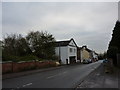
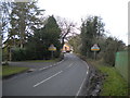
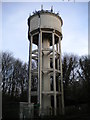
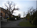
Photos of Quarndon


Area Information
Quarndon is a compact built-up area in England, spanning 65.8 hectares and home to a population skewed toward older residents, with a median age of 70. This suggests a community rooted in stability, where many have lived for decades. The area’s character is defined by its mix of residential properties, with 81% of homes owned by residents rather than rented out. Living here means access to a range of practical amenities, including five retail outlets such as Tesco Allestree and Waitrose Little, as well as rail connections to Derby, Belper, and Duffield stations. The area’s safety is notable, with a crime risk score of 81, indicating below-average crime rates. For families, the nearby The Curzon CofE Primary School, rated ‘good’ by Ofsted, offers a reliable educational foundation. While Quarndon may lack the vibrancy of larger towns, its quiet, well-connected nature appeals to those prioritising security, convenience, and a slower pace of life.
- Area Type
- Built Up Area 250
- Area Size
- 65.8 hectares
- Population
- Not available
- Population Density
- Not available
Quarndon’s residents have access to a range of nearby amenities, including five retail outlets such as Tesco Allestree, Co-op Blenheim, and Waitrose Little, ensuring everyday shopping needs are met. The rail network offers connections to Derby, Belper, and Duffield, while the Idridgehay metro station provides additional transport options. Although the data does not mention parks or leisure facilities, the presence of multiple retail and transport hubs suggests a practical, convenience-focused lifestyle. The area’s quiet nature contrasts with its accessibility to services, making it suitable for those who value a balance between tranquillity and ease of access to essentials.
Amenities
Schools
The Curzon CofE Primary School is the only school explicitly listed near Quarndon, serving the local community with a ‘good’ Ofsted rating. As a primary school, it caters to younger children, but the data does not mention secondary education options in the immediate vicinity. This means families with older children may need to look further afield for secondary schooling. The presence of a well-rated primary school is a key asset for parents, offering a reliable foundation for early education. However, the absence of detailed information on other schools or educational facilities suggests that prospective buyers should investigate further if a comprehensive school system is a priority.
| Rank | School | Type | Entry gender | Ages |
|---|
Explore more schools in this area
Go to Schools tabDemographics
Quarndon’s population is predominantly older, with a median age of 70, reflecting a community where retirement or long-term residency is common. Home ownership is high at 81%, suggesting a stable, settled population with fewer transient residents. The data does not specify household composition or accommodation types, but the overall figures indicate a mature demographic profile. With no specific information on ethnic diversity or religious composition, it is clear that the area’s social fabric is shaped by its age profile and strong sense of local continuity. The absence of detailed breakdowns on deprivation or socioeconomic factors means the quality of life here is inferred from the safety and infrastructure available. For those seeking a low-maintenance, family-friendly environment, Quarndon’s demographics align with a preference for quiet, established living.
Household Size
Accommodation Type
Tenure
Ethnic Group
Religion
Household Composition
Age
Household Deprivation
NS-SEC
Explore more demographic insights in this area
Go to Demographics tabPlanning
Planning Constraints
- Crime RiskPremium