Area Overview for Preston Capes
Photos of Preston Capes
Area Information
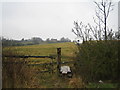
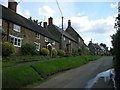
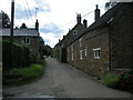
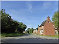
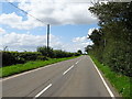
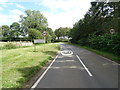
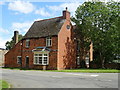
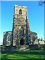
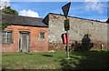
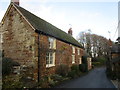
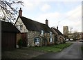
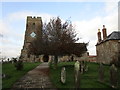
Living in Preston Capes offers a distinct experience within Newhaven, characterised by its status as a defined civil parish spanning just 11.3 km². This relatively small footprint means the community is compact, allowing residents to traverse the entire area with ease while maintaining a clear connection to their immediate surroundings. The locality functions as a quiet residential enclave rather than a bustling commercial hub, separating everyday life from the broader transport networks of the region. As you move through the parish, the atmosphere remains consistent, defined by established housing stock and a lack of significant planning constraints that often disrupt larger developments. The area does not contain Ramsar wetland sites, areas of outstanding natural beauty, or protected nature reserves, which indicates a landscape shaped primarily by human settlement and managed infrastructure rather than strict conservation boundaries. However, you will find that parts of Preston Capes do contain protected woodland. This designation introduces a specific layer to the local environment, suggesting that tree cover and natural habitats are recognised and safeguarded within the parish boundaries. While this may affect future construction in specific pockets, it contributes to a greener setting for current residents. For anyone considering homes in Preston Capes, the combination of a small geographic area and designated green spaces creates a defined living environment where the boundaries between nature and development are clearly marked. You are entering a settled community where the physical limits of the parish are well understood by those who live and work there.
- Area Type
- Parish
- Area Size
- 11.3 km²
- Population
- Not available
- Population Density
- Not available
Demographics
The community in Preston Capes skews significantly towards older residents, with a median age of 70 years. This figure suggests that the most common household members fall into the senior demographic, indicating a retirement village feel or a reliance on established families with grown children. Those seeking homes in Preston Capes is likely looking for an environment where neighbours are peers, rather than a mix of young professionals or families with school-aged children. The demographic profile is not balanced by a large youth population, meaning local amenities cater more towards older needs, from healthcare services to leisure activities suitable for retirement. Home ownership stands at 83% of all households within the parish. This high percentage reveals a strong tradition of resident stability and investment in the area. Most residents have purchased their properties rather than renting, which typically fosters a closer-knit community spirit as people remain in their homes for long periods. You are unlikely to encounter high tenant turnover rates here. The dominant household composition reflects this stability, with many occupants having lived in the same address since the property was bought over several decades. While specific data on ethnicity and religion are not detailed in this dataset, the age profile clearly defines the social rhythm of Preston Capes. Living in Preston Capes means accepting an older neighbourly dynamic, which often translates to quiet streets and established social patterns rather than the constant influx found in younger, mixed-age neighbourhoods.
Household Size
Accommodation Type
Tenure
Ethnic Group
Religion
Household Composition
Age
Household Deprivation
NS-SEC
Explore more demographic insights in this area
Go to Demographics tabPlanning
Planning Constraints
- Flood RiskPremium
- Ramsar Wetland SitesPremium
- Area of Outstanding Natural BeautyPremium
- Protected Nature ReservePremium
- Protected WoodlandPremium
- Crime RiskPremium