Area Overview for Pleasley Ward
Photos of Pleasley Ward
Area Information
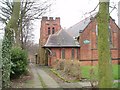
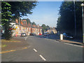
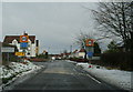
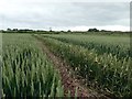
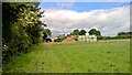
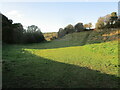
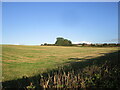
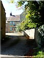
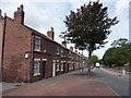
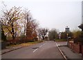
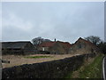
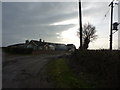
Living in Pleasley Ward offers a quiet life centred on a village and civil parish that straddles the border between Derbyshire and Nottinghamshire. This district, located within the Bolsover area of Derbyshire, spans an area of 4.7 km². You will find Pleasley situated just five miles south-east of Bolsover and 2.5 miles north-west of Mansfield. The River Meden flows through the village, forming the ancient county boundary between Nottinghamshire and Derbyshire. Localities include Pleasley Village, Upper Pleasley, Pleasley Hill, and Pleasley Vale, creating a distinct settlement pattern. Pleasley is not mentioned in the Domesday Book because it was historically part of Glapwell parish. Today, the community is defined by its mix of original sandstone buildings around an old mill site and terraced houses built between 1875 and 1899. The parish church features a grade II* listed structure containing a 1662 font and a pulpit from Derby Cathedral. With a population of 2,305 recorded in 2011, Pleasley remains a relatively small community. The environment includes a steep single-carriageway section on Pleasley Hill and nearby Pleasley Colliery. You live in an area where the road network connects via the A617 and the Pleasley By-pass. The landscape also marks the edge of ancient Sherwood Forest.
- Area Type
- District Borough Unitary Ward
- Area Size
- 4.7 km²
- Population
- Not available
- Population Density
- Not available
Demographics
The community in Pleasley Ward reflects a mature population with a median age of 70 years. This high median age indicates that the area attracts older residents compared to the national average. You will find that the percentage of young families is likely lower than in more urban districts due to this age profile. Home ownership is the dominant form of tenure, with 63% of residents owning their homes outright or with a mortgage. This figure suggests a stable community where long-term residents have settled over many years. The remaining 37% of households likely rent or face affordability challenges common in older, more established villages. Household composition data points to a total demographic spread rather than a single family type dominating the streets. While specific ethnicity and religion statistics are aggregated under total categories, the high home ownership rate often correlates with specific local demographics typical of rural Derbyshire. This demographic structure means you are joining an area where neighbours are likely established and part of longstanding local networks. The age distribution and tenure patterns create a neighbourly environment but may lack the vibrancy of areas with younger populations.
Household Size
Accommodation Type
Tenure
Ethnic Group
Religion
Household Composition
Age
Household Deprivation
NS-SEC
Explore more demographic insights in this area
Go to Demographics tabPlanning
Planning Constraints
- Flood RiskPremium
- Ramsar Wetland SitesPremium
- Area of Outstanding Natural BeautyPremium
- Protected Nature ReservePremium
- Protected WoodlandPremium
- Crime RiskPremium