Area Overview for Pleasley
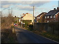
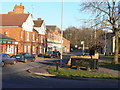
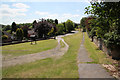
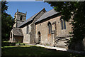
Photos of Pleasley


Area Information
Pleasley is a built-up area in England covering 33.8 hectares, characterised by its compact size and proximity to essential services. The area’s population, while not explicitly stated, reflects a median age of 70, suggesting a community skewed towards older residents. This demographic profile shapes daily life, with a focus on accessibility and established infrastructure. Pleasley’s location offers practical connectivity, with five rail stations within reach, including Mansfield Woodhouse and Shirebrook, facilitating travel to nearby towns. Retail options are similarly accessible, with Co-op Mansfield and Spar providing essential shopping. The area’s compact nature means residents can reach amenities quickly, blending practicality with a sense of familiarity. While the data does not specify broader cultural or social dynamics, the presence of multiple rail links and retail hubs indicates a functional, if modest, urban environment. For those considering living in Pleasley, the balance of proximity to services and a settled community may appeal, though the older demographic suggests a quieter, more established vibe compared to younger, growing areas.
- Area Type
- Built Up Area 250
- Area Size
- 33.8 hectares
- Population
- Not available
- Population Density
- Not available
Living in Pleasley offers access to a range of amenities within practical reach. Five rail stations, including Mansfield Woodhouse and Shirebrook, provide easy access to regional transport, while retail options like Co-op Mansfield and Spar cater to everyday shopping needs. The compact size of the area ensures that these services are not distant, contributing to a convenient lifestyle. Though the data does not specify parks or leisure facilities, the presence of multiple retail and transport hubs suggests a focus on functionality over expansive recreational spaces. For residents, this means a balance between practicality and proximity, with minimal need for long commutes to access essentials. The area’s character is defined by its accessibility and the availability of services that support daily routines, making it suitable for those who prioritise ease of access over larger, more sprawling environments.
Amenities
Schools
| Rank | School | Type | Entry gender | Ages |
|---|
Explore more schools in this area
Go to Schools tabDemographics
Pleasley’s population has a median age of 70, the highest in the dataset, indicating a community predominantly composed of older residents. This age profile shapes the area’s social fabric, with likely implications for local services and amenities tailored to this demographic. Home ownership stands at 69%, suggesting a stable housing market where most residents own their properties. The data does not specify household composition or accommodation types, but the high home ownership rate implies a settled population with long-term residency. The absence of detailed information on ethnic groups or religions means broader diversity metrics remain unexplored. However, the median age and ownership figures collectively suggest a community focused on continuity rather than rapid change. For prospective buyers, this demographic profile may influence considerations about future property value trends and the need for age-appropriate infrastructure, such as healthcare facilities or accessible public transport.
Household Size
Accommodation Type
Tenure
Ethnic Group
Religion
Household Composition
Age
Household Deprivation
NS-SEC
Explore more demographic insights in this area
Go to Demographics tabPlanning
Planning Constraints
- Crime RiskPremium