Area Overview for Pinxton
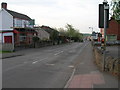
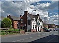
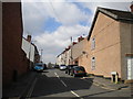
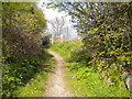
Photos of Pinxton


Area Information
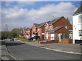
Pinxton is a compact built-up area in England, covering just 1.6 km². Its small size means it feels intimate, with a focus on local amenities and community. The median age of 70 suggests a population skewed towards older residents, which may influence the area’s pace of life. Despite its size, Pinxton offers access to essential services, including schools, retail, and rail links. For those considering living here, the area’s charm lies in its quiet, settled nature—ideal for retirees or those seeking a slower rhythm. The presence of multiple schools, from nurseries to academies, indicates a family-friendly environment, though the demographic data suggests a community more aligned with mature households. Daily life in Pinxton balances practicality with proximity to nearby towns, making it a viable choice for those prioritising safety, stability, and ease of access to services.
- Area Type
- Built Up Area 250
- Area Size
- 1.6 km²
- Population
- Not available
- Population Density
- Not available
Pinxton’s lifestyle is shaped by its proximity to retail and transport hubs. Local shops include Co-op Pinxton and Morrisons Daily, offering essential goods within walking distance. The area’s rail stations—Alfreton, Kirkby in Ashfield, and Sutton Parkway—provide access to nearby towns and cities, facilitating shopping, dining, and leisure opportunities beyond the immediate vicinity. While the data does not specify parks or recreational spaces, the presence of multiple schools and retail outlets suggests a focus on practicality over expansive green areas. The community’s character is defined by convenience, with amenities clustered to serve daily needs. For those valuing ease of access and a settled environment, Pinxton’s lifestyle balances simplicity with functional living.
Amenities
Schools
Pinxton is served by a range of educational institutions, including Pinxton Nursery School, John King Infant School, Pinxton Kirkstead Junior School, Longwood Community Infant School, and John King Infant Academy. The latter is an academy with an outstanding Ofsted rating, highlighting a high standard of education available in the area. The mix of nursery, primary, and academy schools provides options for families at different stages of their children’s education. The presence of an outstanding-rated academy suggests a commitment to academic excellence, which may be a draw for parents prioritising quality schooling. However, the data does not specify catchment areas or school performance beyond the Ofsted rating, so prospective families should verify whether their preferred schools are within reach.
| Rank | A + A* % | School | Type | Entry gender | Ages |
|---|---|---|---|---|---|
| 1 | N/A | Pinxton Nursery School | nursery | N/A | N/A |
| 2 | N/A | John King Infant School | primary | N/A | N/A |
| 3 | N/A | Pinxton Kirkstead Junior School | primary | N/A | N/A |
| 4 | N/A | Longwood Community Infant School | primary | N/A | N/A |
| 5 | N/A | John King Infant Academy | academy | N/A | N/A |
Explore more schools in this area
Go to Schools tabDemographics
The population of Pinxton has a median age of 70, with the most common age range encompassing all age groups. This suggests a community where older residents form a significant proportion, potentially influencing local services and social dynamics. Home ownership is high, at 71%, indicating a strong presence of long-term residents. The data does not specify household composition or accommodation types, but the overall figures suggest a stable, low-turnover area. The absence of detailed diversity metrics means the ethnic and religious composition remains unspecified, though the figures provided imply a relatively homogenous demographic. For buyers, this profile may align with those seeking a retirement location or a place with minimal change. The area’s characteristics—low crime, established infrastructure, and proximity to amenities—support a lifestyle prioritising comfort and security over rapid development.
Household Size
Accommodation Type
Tenure
Ethnic Group
Religion
Household Composition
Age
Household Deprivation
NS-SEC
Explore more demographic insights in this area
Go to Demographics tabPlanning
Planning Constraints
- Crime RiskLocked