Area Overview for Penniment Ward
Photos of Penniment Ward

Area Information
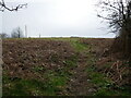
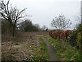
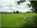
Penniment Ward stands as a distinct district within Mansfield District in the East Midlands region of England. This area covers a total size of 74.3 hectares, providing a defined footprint for residents living in Penniment Ward. Your daily life here is shaped by this specific geographical scope, which sits comfortably within Nottinghamshire boundaries. The ward operates as a borough unitary ward, a designation that defines its administrative standing within the local government structure. When you consider living in Penniment Ward, you enter a settlement that relies on clear structural definitions rather than sprawling urban sprawl. The mapped boundaries associated with the area offer a concrete sense of place for homeowners exploring properties in this location. The region’s profile is anchored by its classification as a ward under the E05014633 code, a fact that influences planning and governance. You will find the ward functions independently while remaining part of the broader East Midlands region. The character of Penniment Ward is defined by these administrative realities. There are no vague descriptions of atmosphere; instead, the area presents as a functional part of the larger Mansfield District. Prospective buyers looking for homes in Penniment Ward should understand this ward forms a specific political and geographical unit. The area's identity is grounded in these facts, offering a clear picture of what life entails within these mapped limits.
- Area Type
- District Borough Unitary Ward
- Area Size
- 74.3 hectares
- Population
- Not available
- Population Density
- Not available
Demographics
The community profile in Penniment Ward reveals a distinctly mature population. Residents living here face a median age of 70 years, indicating a neighbourhood heavily populated by the elderly. This age structure suggests that the daily rhythm of Penniment Ward follows a slower pace often associated with retirement living. The data highlights that the total age range contains this figure, confirming the demographic weight of this cohort within the ward. Home ownership remains a dominant feature, with 65% of households owned outright or with a mortgage. This high ownership rate demonstrates that you are likely to find single-family homes or bungalows suited to older residents. Security of tenure is high compared to areas where rental markets prevail. The prevalence of owned properties implies a community invested in long-term stability rather than short-term tenancies. While specific ethnic, religious, and household composition details are not detailed in the available figures, the primary demographic fact remains the age profile. The population skew toward older adults shapes the local services and social fabric. When you evaluate demographics for homes in Penniment Ward, the age profile is the most critical statistic to note. The area does not cater to young professionals or families seeking dynamic growth like younger wards might. Instead, it serves those seeking a settled environment.
Household Size
Accommodation Type
Tenure
Ethnic Group
Religion
Household Composition
Age
Household Deprivation
NS-SEC
Explore more demographic insights in this area
Go to Demographics tabPlanning
Planning Constraints
- Flood RiskPremium
- Ramsar Wetland SitesPremium
- Area of Outstanding Natural BeautyPremium
- Protected Nature ReservePremium
- Protected WoodlandPremium
- Crime RiskPremium