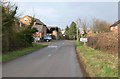
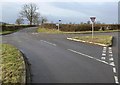
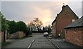
Area Overview for Peatling Magna
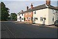
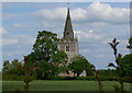
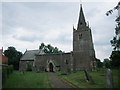
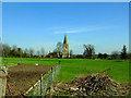
Photos of Peatling Magna
Area Information
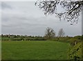
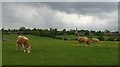
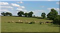
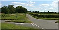
Peatling Magna occupies 7.5 square kilometres within England, offering a defined parish boundary for residents seeking a specific locale. Living in Peatling Magna means inhabiting a civil parish with established boundaries, though the exact population figure is not available in current records. You will find that daily life here is shaped by the area's physical size, which limits the density of development and encourages a quieter existence compared to larger urban centres. Homes in Peatling Magna cater to those who prioritise a settled environment over the anonymity of a major city. The distinct character of this parish is evident in its classification as a civil parish, a structure that often supports local governance and community initiatives. While specific population statistics are absent from the dataset, the land area of 7.5 km² provides a clear context for the scale of the settlement. This size suggests a village-like atmosphere where services may be compact and distances between homes are relatively short. Prospective buyers should note that the area exists as a recognised geographical entity, distinct from surrounding parishes. The combination of a defined civil parish status and a moderate land footprint creates a consistent living environment.
- Area Type
- Parish
- Area Size
- 7.5 km²
- Population
- Not available
- Population Density
- Not available
Demographics
The community profile of Peatling Magna reveals a settlement with a median age of 70 years, indicating a predominantly older population. Most people living in this parish belong to the older age demographic, suggesting a community where retirement or long-term residence is common. With home ownership standing at 84 per cent, the vast majority of households in Peatling Magna are owner-occupiers rather than tenants. This high rate of ownership points to a stable residential base where families have stayed in the area for extended periods. You will find that accommodation types are largely defined by this ownership structure, with few rental properties dominating the local landscape. While the dominant ethnic group, religion, and detailed household composition figures are not explicitly detailed in the provided statistics, the 84 per cent ownership rate is a definitive fact characterising the area. This demographic makes Peatling Magna a destination for those seeking an established community where residents have a direct stake in their residence. The age profile further suggests that amenities and local services will cater primarily to older adults.
Household Size
Accommodation Type
Tenure
Ethnic Group
Religion
Household Composition
Age
Household Deprivation
NS-SEC
Explore more demographic insights in this area
Go to Demographics tabPlanning
Planning Constraints
- Flood RiskPremium
- Ramsar Wetland SitesPremium
- Area of Outstanding Natural BeautyPremium
- Protected Nature ReservePremium
- Protected WoodlandPremium
- Crime RiskPremium