Area Overview for PE9 3UD
Photos of PE9 3UD
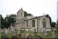
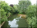
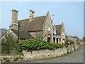
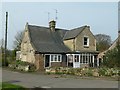
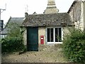
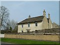

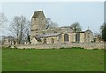
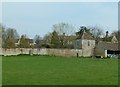
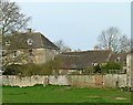
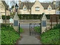
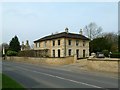
50 photos from this area
Area Information
Key information about the PE9 3UD including its size, population, and administrative classification.
- Area Type
- Postcode
- Area Size
- 59.9 hectares
- Population
- 1156
- Population Density
- 115 people/km²
House Prices in PE9 3UD
47
Properties
£628,237
Average Sold Price
£157,000
Lowest Price
£2,000,000
Highest Price
Showing 47 properties
| Address | Type | Beds | Baths | Last Sale Price | Last Sale Date | |
|---|---|---|---|---|---|---|
| Alderley House, Main Street, Tinwell, PE9 3UD | Detached | 4 | 3 | £1,115,000 | Jul 2023 | |
| Tinwell House, Main Street, Tinwell, PE9 3UD | house | 5 | - | £1,800,000 | Jun 2021 | |
| The Limes, Main Street, Tinwell, PE9 3UD | Detached | 6 | 3 | £1,237,500 | Apr 2021 | |
| Milburn, Main Street, Tinwell, PE9 3UD | Detached | 6 | 4 | £850,000 | Feb 2021 | |
| The Kelpies, Main Street, Tinwell, PE9 3UD | Semi-detached | 5 | 2 | £542,500 | May 2020 | |
| 8 Main Street, Tinwell, PE9 3UD | Semi-detached | 2 | 1 | £231,000 | Oct 2019 | |
| 4-5 Main Street, Tinwell, PE9 3UD | Cottage | 2 | 1 | £330,000 | May 2018 | |
| Reuben House, Main Street, Tinwell, PE9 3UD | Detached | 5 | 1 | £775,000 | Feb 2018 | |
| The Old Village Hall, Main Street, Tinwell, PE9 3UD | Detached | 3 | 3 | £585,000 | Nov 2017 | |
| The Old Rectory, Main Street, Tinwell, PE9 3UD | house | - | - | £2,000,000 | Jul 2017 |
Page 1 of 5
Energy Efficiency in PE9 3UD
Amenities
Schools
| Rank | School | Type | Entry gender | Ages |
|---|
Explore more schools in this area
Go to Schools tabDemographics
Household Size
Two person
most common
Accommodation Type
Houses
most common
Tenure
70
majority
Ethnic Group
White
most common
Religion
N/A
most common
Household Composition
N/A
most common
Age
47
median
Adults (30-64 years)
most common
Household Deprivation
N/A
with no deprivation
NS-SEC
42
in Lower managerial occupations
Explore more demographic insights in this area
Go to Demographics tabPlanning
Planning Constraints
- Flood RiskPremium
- Ramsar Wetland SitesPremium
- Area of Outstanding Natural BeautyPremium
- Protected Nature ReservePremium
- Protected WoodlandPremium