Area Overview for PE9 3RN
Photos of PE9 3RN


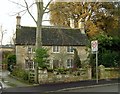
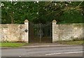

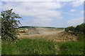
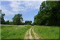


36 photos from this area
Area Information
Key information about the PE9 3RN including its size, population, and administrative classification.
- Area Type
- Postcode
- Area Size
- 3.9 hectares
- Population
- 1674
- Population Density
- 78 people/km²
House Prices in PE9 3RN
32
Properties
£160,363
Average Sold Price
£36,000
Lowest Price
£375,000
Highest Price
Showing 32 properties
| Address | Type | Beds | Baths | Last Sale Price | Last Sale Date | |
|---|---|---|---|---|---|---|
| 20 Luffenham Road, Ketton, PE9 3RN | Semi-detached | 3 | 1 | £335,000 | Nov 2025 | |
| 44 Luffenham Road, Ketton, PE9 3RN | house | - | - | £200,500 | Nov 2020 | |
| 18 Luffenham Road, Ketton, PE9 3RN | house | - | - | £211,000 | Jan 2020 | |
| 40 Luffenham Road, Ketton, PE9 3RN | Semi-detached | 2 | - | £231,600 | Jun 2017 | |
| 4 Luffenham Road, Ketton, PE9 3RN | Semi-detached | 3 | 2 | £170,000 | Aug 2016 | |
| 2 Luffenham Road, Ketton, PE9 3RN | Semi-detached | 3 | 2 | £220,000 | Jan 2016 | |
| Rookery View, 54 Luffenham Road, Ketton, PE9 3RN | Bungalow | - | - | £375,000 | Apr 2015 | |
| 32 Luffenham Road, Ketton, PE9 3RN | house | 2 | - | £110,950 | Jan 2012 | |
| 36 Luffenham Road, Ketton, PE9 3RN | Terraced | 3 | 1 | £112,500 | Jul 2005 | |
| 46 Luffenham Road, Ketton, PE9 3RN | Semi-detached | - | - | £141,000 | Jul 2004 |
Page 1 of 4
Energy Efficiency in PE9 3RN
Amenities
Schools
| Rank | School | Type | Entry gender | Ages |
|---|
Explore more schools in this area
Go to Schools tabDemographics
Household Size
Two person
most common
Accommodation Type
Houses
most common
Tenure
82
majority
Ethnic Group
White
most common
Religion
N/A
most common
Household Composition
N/A
most common
Age
47
median
Adults (30-64 years)
most common
Household Deprivation
N/A
with no deprivation
NS-SEC
47
in Lower managerial occupations
Explore more demographic insights in this area
Go to Demographics tabPlanning
Planning Constraints
- Flood RiskPremium
- Ramsar Wetland SitesPremium
- Area of Outstanding Natural BeautyPremium
- Protected Nature ReservePremium
- Protected WoodlandPremium